This article will dive into the main aspects of distance and length. Here, we will attempt to review length through its geographical—and, by extension, cultural—significance for human societies, both in modern times and from a historical perspective.
And our internal voice hints that we cannot avoid, in our considerations, such questions as why length as a subject should be understood as a physical unit, rather than simply a geometric operational element. Only a detailed consideration of space and baryonic matter will help us uncover the depth of this approach. Therefore, we recommend that our users remain patient in such cases, when our narrative may appear somewhat lateral to the main topic of the article. Of course, no penalties will be imposed on readers who skip some paragraphs, but careful readers will ultimately reap the significant rewards of a clearer understanding of the fundamental principles we outlined below...
But in the introduction, we have found it necessary to offer a little “candy,” so that the reader may continue to glance through the otherwise rigorous and scholarly content… Isn’t that so?
Here, below, along with other nuances of the contextual inclusions, you will find detailed descriptions of the length and area units of the main cultures famously known to date. This includes the units of Ancient and Medieval China, the Indian metric system, Greece, Rome, early European length units, as well as the approaches to distance measurement in Slavic territories, as recorded in old historical tomes—sometimes even more legendary than what archaeological evidence has preserved to our time...
Without Space No Lengths, And There Only Nothing...
About Words, And Their Values
Baryonic Misterious
We already mentioned the 'baryonic' word in our preface paragraph, and may be here the place to define what is this and with what to eat it?
Briefly, as you may have heard from some scientific broadcasters, the universe — to which we have a certain observational relationship — consists of several kinds of matter. Cosmology and particle physics describe elementary particles as having wave–particle duality, meaning their structure is fundamentally wave-based. Only matter with compatible wave structures can interact or detect these elements, providing information about the existence of objects we seek to observe. This type of detectable matter corresponds to baryonic matter, the ordinary matter that forms stars, planets, and living beings.
We here will intentionally skip so-called dark matter and dark energy, which still occupy a place in scientific discussion clubs. But what about space? What beast might we classify it as?
Like any creature with a relatively high ability to move, we are vitally dependent on the perception of our environment — the surroundings that help us recognize the territory we occupy, identify targets we may approach, and gauge the distances we need to overcome for activities essential to our survival. All of this is depicted before continuing in the dedicated space. This space is so ordinary for us that we rarely think of it in terms of its physical properties; instead, all other objects — air, earth, stones, and everything we can manipulate or interact with — are matter for us.
And here we are closely approaching the definition of the distance. Mainly, as we noted above, our operational element for environmental relationships is the distance. But distance is only our representation of the space fraction for simplification to applicable units within the space. And if space itself is not a constant value, for us the distance will still be constant. Else all the coordinate systems and reference points will completely destroy our adaptability, which in its turn strictly depends on patterns shaped during the lifespan of the life owner...
Based on recent astrophysical observations, the space within our observable horizon is not constant. Intuitively, we might suggest that distance is tightly linked to the volatile fringe at the visible “end of the universe.” Yet we still rely on standardized patterns in our measurements, and to our perceptions, all of this appears static and unchanging. This raises an important question: is distance truly constant, or is it constant only in terms of our measurements and perception?
Nevertheless, space and distance are of the same nature. The difference between them lies mainly in perspective: distance is an artificial construct, invented and applied by humanity, while space is a physical reality. And distance is only the tool (from the set of them) applied by humanity in its ridiculous efforts to grasp the universe.
Mr. Obviousness, Or Thoughts About Everyday Life
Slippers Under Bed
Let's do a simple restoration of a common day chain of events, as truly detectives do. Now it is 12 o'clock in the afternoon, the first of December, 1972 (or 3072, which actually will not be important in the simple case of existing humanity as a biological species). I slept well and woke in excellent mood. By standing up from the bed, I palped with my right leg a slipper, as I exactly leave the slippers in the centre and under the edge of the bed. So, in this simple fragment, we may notice several interesting facts, about which we rarely even try to think.
Waking up is the process where we are returning from another stage of our consciousness to awareness of where we are physically and what is going on. Then, into the scene comes out our memory processing mechanism, which leads to the restoration of long-range associative objectal-oriented patterns, such as bed, slippers, positioning, room, all objects’ purposes. And the third mechanism is responsible for the physical interactions with third-party objects and the mobility of our own body.
Related to our own body (which is a very notable element of the system), we unconsciously use the tool as a set of receptors to probe and respond to the probes of any actions we do, based on the mentioned above memory-patternal system. And when we remember that we palped the slipper with our right leg, it means we know where approximately our body is placed now; by this awareness, we take a fulcrum point, moving, revolving our body so as to let our leg manipulate in the space and coordinate the leg to palp the slipper. And we know how to manipulate our tool (leg) because we exactly know our leg’s act parameters in the space. From now, these parameters will be the starting position of unconscious distance measurements.
Then I walk to the bathroom to visit my old friend, the night vase — hurry up, if I want my underwear to be dry. Timing... How do I know how much time the trip to the bathroom will take, to open the door, and all complex activities I need to do to arrive in time to the desirable device, which as a result helps me save my underwear from becoming a wet rag? Let's reconstruct the chain of events we do unconsciously to obtain a desirable result.
When we stood up, put on slippers, rushed to the bathroom door (there should be several steps), and exactly knew where to stop and which leg should set the required position to conveniently straighten the arm, push the door handle, open the door. There is our awareness of all our body parameters. From our life experience, we knew about the average distance of a step we take, and depending on the required actions, we manipulate the step lengths. So the basic parameter is our patternal mechanisms recalculating the lengths of legs to preconstruct the required step length. When I stop and straighten the arm, our patternal mechanism, the same way as with the step situation, preconstructs the parameters of my hand.
From these examples, we may make some derivations about how we orient within the space by algorithms designed for us in evolutionary processes. So here we may trace even the natural approach of standardisation of dedicated objects and the implementation of these standards into the environmental reality.
Distances, And Measurements In Human Implementation
As widely known, communication between social creatures is critically important for their survival strategy. And the main purpose is only the survival of the individual. This is an evolutionary axiom we will not discuss here. However, the authors found some facts in the preface necessary to proclaim.
From entomologists, we know facts about bees’ dances, which serve as a part of information exchange (or sharing important data) about the location of prospering edible flowers. This dance ritual involves flying from side to side, with hanging points, and each movement conveys information about the direction the bee should fly, the duration of flight to the required location, and basic information about the type of source, as indicated by the dancer through this dance.
In the provided example (link to the source, see 'Bees communication – See more' below the paragraph), you may notice that the dance itself has parts that can be interpreted as standardized elements — timing of hanging, directional movements, etc. The fact that the colony society understands this data leads us to conclude that such behavior is absolutely unavoidable among social creatures.
Similarly, within human social life, distance, directions, and many other orientational elements emerge once a commune is established. We suggest that only humanity has such a communication tool as language, and this is our general advantage that differentiates humanity from all other biological species (let’s leave utterance aside for the current topic). This observation leads to the reasonable outcome that we can always organize all important and socially valuable matters.
So, taking into account the above narrative, we may go ahead and dive into observations of the ways and methods by which humanity arranges distances and their measurements across cultures, and from a historical perspective, in order to grasp the full picture of the topic we are assembling here to explore...
Unknown And Undefined, But Humanity Belongs
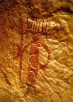
Did You Ever Heard About The Ishango Bone, Or What About 20000 BC Date?
In 1950, Belgian geologist and anthropologist Jean de Heinzelin de Braucourt unearthed the Ishango Bone during excavations near the Semliki River, close to Lake Edward, on the border between modern-day Uganda and the Democratic Republic of the Congo. The bone is approximately 10 cm in length and is believed to be a fibula from a baboon or another large mammal. It is housed at the Royal Belgian Institute of Natural Sciences in Brussels, Belgium.
The Ishango Bone has been the subject of extensive research, leading to various interpretations. Some researchers suggest that the notches on the bone represent early arithmetic operations, possibly indicating knowledge of prime numbers and basic arithmetic functions. Microscopic examinations have led to the hypothesis that the notches may correspond to a lunar calendar, potentially used for tracking lunar phases. Other studies propose that the notches reflect a base-12 counting system, with sub-bases of 3 and 4, suggesting a complex numerical understanding. A 2025 study identified structural patterns in the notches, revealing repeating sums and dualistic pairing structures, indicating a deliberate and complex mathematical arrangement. The Ishango Bone is considered one of the oldest known mathematical artifacts, providing insight into the cognitive and cultural practices of prehistoric societies. Its study continues to offer valuable perspectives on early human numeracy and symbolic thinking.
Assuming the excavated artifact, we can only speculate about its direct use, but the marks and the logic of its positional structure suggest that some form of relative metrical standardisation should reasonably be considered among all other suggestions...
Further, we will lead our honorable reader through the chain of the main well-known ancient cultures, and will provide the generalizations just before we leap into the medieval period of length standardisation...
Measurements Around World's Cultures...
From a commonly accepted approach, and for the reader’s convenience, this section will present an overview of the different cultural groups from the so-called ancient times and their standards of length measurement. We will move from continent to continent, listing the main known societies that are well represented in archaeological discoveries and whose findings scientists have contributed to the knowledge base of humanity...
African Continent.
This section presents a collection of cultures documented through archaeological evidence across the African continent. Each paragraph introduces a culture and provides a brief description of it, along with its systems of measurement, units of length, and short explanations of those units. In cases where sufficient data are available, the units will, of course, be accompanied by conversion tables to modern metric values.
Nabta Playa, Or Pure Evidences of Measurements Used But Even Speculations Will No Define The Units...
Nabta Playa is a large dry basin (playa) in the southern Egyptian/Nubian Desert that was seasonally filled and habitable in the early–mid Holocene. Archaeological occupation begins in the early Holocene and intensifies in the 7th–5th millennia BC (radiocarbon ranges for different components span roughly ~7500–4500 BC depending on feature). The environment then supported lakes, wells and pasturage that attracted seasonal or semi-sedentary groups.
Scientific Summary
Evidence shows organized seasonal camps and, later, more permanent village-like layouts with wells that held water year-round. Subsistence included wild plant gathering and, increasingly in the mid-Holocene, pastoralism (domestic cattle, goats/sheep appear in the record), and cultivation/management of plants such as millets/sorghum is suggested in some analyses. Large hearths, pottery and tool assemblages indicate complex, repeated occupation and food processing activities.
Metric System Existed?
Archaeologists have documented tumuli (burial mounds), carved/worked stones, pottery (decorated in later phases), hearths, deep wells, and stone alignments/cromlechs (stone circles). Cattle burials (ritual interment of cattle in clay-lined chambers) are a prominent feature of some phases, indicating the cultural importance of cattle.
The site contains stone alignments and a so-called “calendar circle” (a ring of paired standing stones with internal standing slabs). Several researchers interpret some megalith orientations as pointing to sunrise on the summer solstice and to bright stars — i.e., the site may preserve early archaeoastronomical practice used to mark seasonal events (important for pastoralists tracking rains). However, the precision and intended use are debated; many specialists emphasize that while alignments are plausible, their calendrical accuracy and symbolic meanings remain interpretive.
There is no widely accepted, directly attested standardized ruler/unit of length from Nabta Playa. What exists are geometrical and dimensional analyses of megalith layouts and speculative proposals that patterns reflect implicit measurement schemes. Those proposals range from conservative (geometric/layout relationships) to very speculative (direct numerical length units or “star-distance” scales). Below I summarize main positions and the evidence backing or opposing each.
Some researchers (e.g., Shatalov, Haynie and others in analytic/geometry studies) have suggested the stone circle follows dimensional-geometric relationships — i.e., repeating length ratios and angles that could reflect a working measurement concept (for laying out plans, aligning monuments, or marking seasonal positions). These are mathematical/architectural interpretations based on measured inter-stone distances and angular relationships. They do not prove a named unit like “a Nabta foot” existed, but they do suggest intentional patterning.
A small number of authors (not mainstream archaeologists) have proposed exotic claims — e.g., that the stones encode precise stellar distances or an advanced long-distance astronomical scale (the Brophy “star map / distance scaling” idea is a prominent example). These claims are not accepted by the mainstream archaeological/astronomical community because they rely on selective measurements, disputed correlations, and assume intentions not demonstrated in the field record. Scholarly rebuttals and re-analyses emphasize that such results are not robust given dating uncertainties and measurement/interpretation biases.
Merimde Beni Salama (commonly called Merimde) 5000 BC Dated. Speculative Measurement Units...
Merimde Beni Salama (commonly called Merimde) is located in the western Nile Delta. Occupation dates primarily to the late 6th to early 5th millennium BC (~5000 BC), during the Neolithic period. The site represents one of the earliest sedentary village cultures in the Nile Delta region, contemporary with Buto and other predynastic cultures.
Evidence shows permanent villages with rectangular houses made of wattle-and-daub. Subsistence was primarily agricultural, including cultivation of emmer wheat, barley, and legumes. Animal husbandry included cattle, sheep, goats, and possibly pigs. Fishing and fowling supplemented diets due to proximity to Nile wetlands.
Burials found at Merimde show flexed interments, sometimes with grave goods, suggesting emerging social stratification. The scale of settlement and planning implies some coordinated community management.
Merimde represents a stable, early sedentary community in the Nile Delta. Demonstrates Neolithic innovations: crop cultivation, domesticated animals, settlement planning. These innovations set the stage for later predynastic Egyptian cultural development.
Archaeology In Facts And Speculations
Nevertheless, there are no standardized metric system has been found at Merimde, archaeologists have recorded dimensions of houses, hearths, and storage pits, allowing reconstruction of approximate building modules. Measurements suggest consistent proportions, e.g., houses roughly 4–5 m wide, but this appears practical rather than formalized.
Some researchers suggest that building layouts reflect repeated units (possibly pacing or rope lengths). No artifacts like rulers, marked rods, or inscriptions survive, so any proposed unit is hypothetical.
Assumption may led us to thoughts, that metrics in the culture were based on human-based measures (arm span, step, or pacing) applied consistently in local construction.
Initial Discoveries
The site was first identified by Hermann Junker during his West Delta Expedition in 1928. Excavations were conducted from 1929 to 1939, uncovering domestic structures, lithic tools, and faunal remains
The complex analytical review of old world neolithic the mediterrian basin
In recent years, research into the Neolithisation of both Europe and North Africa has been increasing, notably so into the process by which varied communities adopted new food producing strategies. The implementation of new technology, methods, and theories have contributed to refinements in the timing of change in economies, analysis of the types of food eaten, and the reasons behind these transformations
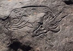
Tassili n’Ajjer Cultures Sahara, Or Continuing Efforts To Find Length Units Evidences...
About Culture, And Bovidian or Pastoral Period (6000 - 4000 BC)
During this era, the Sahara experienced a gradual aridification, leading to the decline of large wild fauna and the emergence of domesticated animals like cattle, sheep, and goats. The rock art from this period vividly depicts these transitions, showcasing scenes of pastoral life, domesticated herds, and human figures engaged in daily activities. Notably, the Running Horned Woman, a prominent painting from this time, illustrates a female figure adorned with bull horns, symbolizing fertility and the integration of cattle into Saharan societies
Archaeological findings in the region, including settlements, tumuli, and enclosures, have yielded abundant ceramic materials, providing further context to the rock art. These artifacts suggest a complex society with developed cultural practices and social structures. The presence of architectural elements in the artwork, such as representations of tents and enclosures, indicates an evolving understanding of space and community organisation
Length Units ..?
While there is no direct evidence of standardized measurement systems (such as units of length or volume) from the Bovidian period, the rock art provides indirect insights into the spatial organisation and scale of prehistoric societies. The depiction of human figures, animals, and architectural elements suggests an understanding of proportionality and spatial relationships.Some researchers have examined the proportions of human figures and animals depicted in the rock art. The consistent use of specific ratios in these depictions suggests an inherent understanding of proportional relationships, which may have served as a rudimentary form of measurement. For instance, vessels with a circumference of one 'royal cubit' were found to hold approximately half a 'hekat' of liquid, indicating an early system of volumetric measurement. The spatial organisation of settlements and enclosures, as inferred from archaeological findings, suggests an understanding of spatial relationships and dimensions, possibly indicating the use of informal measurement units.
The site sits beside what was once a palaeolake (Lake Gobero), around 3 km in diameter during humid periods. The geology includes paleodune (ancient sand dunes), lake deposits, and a fault ridge in the underlying dinosaur-age sandstone that helps explain water supply sometimes-independent of rainfall. More broadly say, Gobero located in the southern Sahara, in Niger, on the western edge of the Ténéré desert.
There are ~182 burial sites, ~67 excavated in early reports. The early burials (Kiffian) are hyperflexed: bodies tightly flexed (knees to chest etc.).
From the anthropological point of view, we may describe the culture by artfacts, excavated, and include such grave goods as pottery, beads, ivory, bone ornaments; harpoons, hooks, etc.
The Archeological researching propose the summary that common activity of the local population were fishing (tilapia, Nile perch, catfish), use of aquatic fauna (softshell turtles, crocodiles), hunting savannah fauna, collecting plant resources, making tools (stone, bone). In the Tenerian phase some evidence of animal domestication/herding appears, though not a dominant signature in all middens.
Measurements In Gobero ...
Here authors should provide disclamer, that no direct evidences of the measurement units the culture may show to us, what in other words may shaped as: nevertheless Gobero is richly documented in many respects, the archaeological record does not show evidence of any formal or standardized system of length units (like “foot,” “cubit,” etc.). Next couple additional points will arguing the tesis.
No rulers, measuring rods, inscribed linear scale artifacts have been reported in published literature as of now. Archaeological reports have not identified consistent repeated architectural modules (walls, building sizes, or enclosures) that could clearly imply formal measurement units. The middens, pottery, and burials provide size data (e.g. skeleton heights, tool sizes), but these are not evidence of a cultural standard for length — more individual or functional.
But we took upside our own responsibility and here is a field of our suggestions...
The height of people, the sizes of tools and vessels, distances walked (movement around the lake) could be relatively standardized in practice even if informal. For example, measurement of fish sizes, fishhooks, or consistency in tool lengths might imply some “rule of thumb” measures. But no direct evidence. If many implements (stone blades, axes, hafts) have very similar size ranges, that suggests craft traditions with preferred dimensions — this could be a proto-unit standard. But published works focus more on typology of tools rather than exact size standardisation. Burials in cemeteries with patterned placement; habitation/refuse areas near the lake edges and dunes. This may reflect spatial organisation, but not yet shown to use measurement units. Pottery shapes are documented (jars, bowls), and some decorated with standard decorative motifs; whether that implies volume units or size standardisation is not shown.
Cultural Transition From African Prehistory to Sumer and Egypt, Or Great Migration Pathway
A widely spread approach of attempting to support any claim with notifications akin to “British Royal Society Discovers That Wet Underwear Is a Sign of Genius” is not our way. When certain points need to be declared, our honorable reader should be patient and ready to consider the arguments that supplement the declarations we provide in this article.
Fairly speaking, modern anthropology generally accepts the hypothesis of a human migration pathway from the African continent. Instead of relying on statements like “Some Society Discovers,” this hypothesis is supported not only by declarations but also by numerous archaeological evidences (see the link below: “Great Migration Pathway… see more”).
In this chapter, we will uncover the evolution of measurement systems, and it is logically appropriate to walk through the Mediterranean area, then return to Africa with its Egyptian civilisation, and continue to the Jewish kingdom.
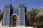
Between The Tigris And Euphrates, Or Cradle Of Civilisations
This chapter is dedicated to the Sumerian Kingdom. Here, we briefly outline the main social and cultural characteristics of the civilisation, while a more detailed review awaits us in the discussion of the metrological tools of the culture that have been discovered to the present day.
About Sumer, Or What We Know Now...
Sumerian Civilisation City Excavations
The period, usually encountered by researchers as the temporal framework for describing the Sumerian civilisation as both a socio-cultural and historical phenomenon, is dated roughly to 4500–1900 BCE. Briefly, the area encompassed within their sovereignty covers mostly southern Mesopotamia (modern southern Iraq), between the Tigris and Euphrates rivers. In most cases, the Sumerians are considered the world’s first urban civilisation, credited with early developments in writing (cuneiform), law codes, irrigation, and organized city-states.
In short terms, the Sumerian economy may be described as based on agricultural surplus via irrigation, trade networks with Anatolia, the Persian Gulf, and the Levant, and craft specialization including metallurgy, pottery, and textiles.
Let us now turn to the social structure. One may reasonably ask why we include such extra-informative data, especially when a reader might be visiting this article solely to learn about the units of length used by the culture. In our defense, we must emphasize that without understanding the cultural context, any single artifact is scarcely interpretable. Each artifact serves as a manifestation from which we derive meaning, allowing us to interpret it (in the context of this article) as a measurement unit.
Below, you may find a table of the most important Sumerian archaeological artifacts, including their type, purpose, and approximate dates. This is factual and concise, suitable for research reference.
Sumerian archaeological artifacts
Artifact / Object
Type
Purpose / Use
Excavation Site
Approx. Date (BCE)
Notes / Significance
Clay accounting tablets
Administrative
Recording rations, taxes, trade
Ur, Lagash, Girsu
2100–2000
Documented economic activities; critical for metrology studies
Mathematical tablets
Educational / Administrative
Arithmetic, geometry, metrology
Ur, Nippur, Uruk
2000–1800
Show use of sexagesimal system; measure length, area, volume
Balance stones / weights
Standardized weights
Trade, taxation
Ur, Kish, Lagash
2500–2000
Basis for shekel, mina, talent; standardisation of commerce
Cubit rods / measuring rods
Length measurement
Land surveying, construction
Ur, Nippur
2500–2000
Standardisation of nindan, šu, kush
Cylinder seals
Administrative / Authentication
Trade contracts, legal documents
Ur, Uruk
3000–2000
Ensured transaction authenticity; used in record keeping
Ziggurats
Religious / Administrative
Temples, economic centres
Ur (Ziggurat of Ur), Uruk, Lagash
2100–2000
Temples served as both religious and economic hubs
Rationing bowls / vessels
Volume measurement
Grain, beer, oil rations
Lagash, Girsu
2100–2000
Units: sila, ban, gur; evidence of economic metrology
Land survey inscriptions
Stone / Clay
Boundary marking, field measurement
Lagash, Girsu
2500–2000
Standard lengths (nindan, šu) used in land allocation
Astronomical / Calendar tablets
Observational
Timekeeping, irrigation, festivals
Nippur, Ur
2000–1800
Early astronomy; linked to practical scheduling of resources
Royal inscriptions / Steles
Political / Religious
Laws, deeds, achievements
Ur, Uruk, Lagash
2600–2000
Record kings’ activities; sometimes contain standard measures
Sumerian Social, And Economy Structure Overview...
Each city was a self-contained urban centre, typically organized around a ziggurat, a massive temple complex that dominated the skyline. The ziggurat was not only a religious focal point but also the administrative hub, where economic activities like storage, rationing, and taxation were organized. Surrounding the temple were the palaces of rulers, homes of the elite, marketplaces, workshops for artisans, and residential quarters for ordinary citizens. Canals and irrigation networks extended outward, linking the city to its agricultural hinterland.
The king held political, religious, and military authority. He oversaw the defense of the city, controlled the distribution of resources, and directed public works like canals, walls, and temples. Kings also supervised standardisation of measures, ensuring that length, volume, and weight units were uniform across the city and its territories. Famous kings include Gilgamesh of Uruk, celebrated for his monumental constructions and city walls, and Ur-Nammu of Ur, known for codifying law and commissioning ziggurats.
Trade in Sumerian cities was highly organized. Local and long-distance commerce involved goods like grain, oil, beer, textiles, and metals. Merchants used standardized weights and measures to conduct fair exchange, while temples and palaces managed taxation and resource distribution. Taxes could be paid in grain, livestock, labor, or precious metals, and were meticulously recorded on clay tablets.
Sumerian “scientists” were temple-affiliated specialists who applied practical knowledge to administration, trade, and construction. We may subddivide their role to several classes of implementation
Scribes: Maintained cuneiform records of trade, taxation, land, and labor. They were essential in recording and applying standardized measures of length, volume, and weight.
Mathematicians: Created arithmetic tables, multiplication tables, and geometric calculations, supporting construction, land measurement, and economic management.
Surveyors: Measured fields, canals, and building sites using standard rods and units (nindan, šu, kush). Their work ensured fair taxation and accurate construction.
Astronomers / Calendar Specialists: Observed celestial bodies to create lunar calendars, which determined irrigation schedules and religious festivals.
Weighing / Volume Specialists: Standardized units like shekel (by the way, do you noted some naming relation to modern Israel currency?), mina, talent (weight) and sila, ban, gur (volume), ensuring uniformity in trade and taxation.
Sumerian Civilisation Summary Table
Category
Unit / Element
Approx. Metric
Subdivisions
Purpose / Use
Evidence / Artifact
Source / Reference
Length
Ammatu (Cubit)
~49.5 cm
1 nindan = 12 ammatu
Construction, urban planning, canal layout
Measuring rods, architectural plans, bricks
Kramer 1981; Postgate 1992
Nindan (Rod)
~5.94 m (≈ 12 cubits)
1 nindan = 12 ammatu = 72 šu = 360 kush
Land surveying, long-distance construction
Copper alloy standard rods (Nippur), boundary markers
Civil 2000; Postgate 1992
Šu (Foot)
~29.7 cm
6 šu = 1 ammatu
Small-scale construction, crafts
Bricks, building remains
Civil 2000; Jacobsen 1960
Kush (Finger)
~1.65 cm
30 kush = 1 ammatu
Fine measurement for surveying and crafts
Clay rods with markings
Kramer 1981; Civil 2000
Beru (Double Rod)
~11.9 m (≈ 2 nindan)
2 nindan
Large distances (roads, canals)
Surveying tablets, boundary markers
Postgate 1992; Civil 2000
Volume
Sila
~1 liter
Base unit
Grain, beer, oil rations
Clay measuring vessels, ration tablets
Kramer 1981; Civil 2000
Ban / Ban-gur
~10 sila
10 sila = 1 ban
Daily rations, smaller grain measurements
Economic tablets, administrative records
Postgate 1992; Civil 2000
Gur
~300 liters
1 gur = 300 sila
Temple storage, taxation, bulk grain
Tablets from Ur, Girsu, Uruk
Kramer 1981; Jacobsen 1960
Nindan-cube
Derived from length units
–
Storage volume calculation, construction
Clay models, storage vessels
Civil 2000
Weight
Shekel
~8.33 g
Base unit
Weighing silver, trade, taxation
Stone weights, balance stones
Kramer 1981; Civil 2000
Mina
~500 g
60 shekels = 1 mina
Trade, taxation
Weights, balance stones
Postgate 1992
Talent
~30 kg
60 minas = 1 talent
Large-scale trade, metals, temple offerings
Stone weights, tablets
Civil 2000; Jacobsen 1960
Mathematics / Calculations
Arithmetic
–
–
Addition, subtraction, multiplication, division
Clay tablets, accounting texts
Robson 2008; Kramer 1981
Geometry
–
–
Land surveying, canal construction, temple layout
Field measurement tablets, architectural plans
Postgate 1992; Civil 2000
Problem-solving / Algebraic
–
–
Workforce distribution, rations, contracts
Ur III tablets, word-problem tablets
Robson 2008
Sexagesimal system
Base-60
–
Astronomy, timekeeping, fractions, accounting
Numerical tablets, astronomical records
Friberg 2005; Civil 2000
Astronomical / Calendar
–
–
Lunar calendars, irrigation scheduling, festivals
Observational tablets
Kramer 1981; Postgate 1992
Measurement Units (Incredible, at great length, we come to lengths?)
Length, Volume And Weight Units
First of all, we have to insert here a remark related to the symbolism and abstract nature of measurement units as socio-cultural phenomena. Like any other form of social agreement, standardisation—whatever form of unification it represents—is an exclusive characteristic of the culture that possesses those standards. Further evolution of intersocial communication may lead to sameness (or perceived sameness) and to the migration and inheritance of measurement units from one culture to another...
Sumerians developed a system of measurements for practical purposes like construction, land allocation, and trade. Archaeological evidence comes from cuneiform tablets recording transactions, construction, and surveying.
About the length, main derived from encrypted sources are: Cubit (nindan / šu-si) ≈ 49.5 cm, Foot (šu) ≈ 30 cm, Kush (finger) ≈ 1/30 nindan (Cubit as shown before).
We may not overpass the volume units, and they are: Sila (liter unit) ≈ 1 liter, Gur = 300 sila (used in grain, beer, and oil)
The weights are represented with: Shekel ≈ 8.33 grams, Mina = 60 shekels ≈ 500 g, Talent = 60 minas ≈ 30 kg
We suppose that any extensive discussions about the context of any phenomena linked to socio-cultural expression always trickle down, like a small creek falling into the lake of inner-societal tools of personal communication, interaction, and evolving social behaviour—gradually shaping and establishing the rules and norms formed through communication itself, will not have a place here. But, since measurement units belong precisely to that realm of norms and rules, a brief consideration remains justified.
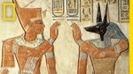
The Old Nile River, Or Egypt And Its Measurements
The Main Chatting Theme at the Beginning of the 20th Century Among Europeans Was...?
As any life depends on water, so agriculture-based civilisations critically depended on the irrigation. And the River, in its turn, as a loving mum, with a readiness to give them all, humanity took the shores, where humans deployed their fields and farms, the water, which we use in melioration purposes, its countless fauna, we shamelessly consume with never telling thanks. As it is now, such it was...
In this chapter, we attempt to discover the main cultural background of the Ancient Egyptian civilisation, and the only purpose of the narration is to immerse the reader in the context of the culture. Only in this way will we be able to list the measurements as applicable units and trace their further evolution within other cultures...
Settlements And Habitant Groups On Nile Shore, Or Before The Kingdom Times Of Egypt
Unfortunately, we have no clear evidence related to proto-Egyptian sites, and this is reasonably conditioned by later cultural layers, which mainly erase and intertwine the possible artefacts, potentially revealing much about the groups.
But, based on the logic of all other similar cultures’ evolution, we may firmly assert that they were. In order not to be compromised as suspicious writers, we mark all later context of this section as unproven narration, designed by the authors for clarification purposes only, and solely to expose to the readers our approach to hypothesis building, in cases when the scientific brain heavily strives from lack of facts.
Early Egyptians lived along the Nile Valley, from the Delta to Upper Egypt. Villages were small (hundreds to a few thousand people), with clustered mudbrick houses. Based on irrigated agriculture (wheat, barley, flax) and supplemented by fishing, hunting, and livestock. Some communities show specialization, e.g., Predynastic cemeteries with high-status grave goods.
Stratification in early sites, as these were communities of course, naturally took place, and at that time may only boast goods diversity, family consumption in everyday life, and grave richness with ritual artefacts. Related to site-times, scarcely may it be adoptable even to suppose some kind of cosmetics or ornaments, which are usually more related to ritual attributes than personal use.
Cities, Settlements And State Formation, Brief Overview...
Hierakonpolis (Nekhen): One of the largest Predynastic centres, with religious and administrative functions, early temples, and elite tombs.
Abydos: Necropolis and ritual centre with evidence of long-distance trade and centralized burials.
Naqada: Regional centres with pottery workshops and cemeteries showing social hierarchy.
Settlements were often clustered along Nile tributaries, reflecting control of water and land as key resources.
Hey, we are hearing: it is not necessary to urge us. Now is the time of Pre-Dynastic State Formation and Political Evolution!
By c. 3100 BCE, Upper and Lower Egypt show signs of unification under a single ruler (traditionally Narmer/Menes). The conditions, general, and historically defined as required, all were relevant to that period: requirements of controlling irrigation networks, defense against raiders and nomadic incursions, economic integration (trade, tribute), religious authority concentrated in a single hand (kingship and temples as administrative hubs).
You may consider several places of archaeological excavations as evidence of state evolution: Narmer Palette (ritual unification symbolism); fortifications at Hierakonpolis and Tell el-Farkha; elite tombs with standardized grave goods; early writing (tags, labels) indicating administrative record-keeping.
Now Is The Right Place for Mapping Egypt Development As State
Badarian Culture (ca. 5500–4000 BC) placed at Middle Egypt, centred on Badari (Asyut area), mainly characterized with early agricultural villages; rudimentary craft specialization; copper use begins, without direct evidences of political structure.
So we may set the point as cultural and economic foundation of later Upper Egyptian societies.
Conditional Period
Naqada I (Amratian) Period, positioned at Upper Egypt (Naqada, Hierakonpolis, Abydos), may be characterised with increasing settlement hierarchy, long-distance trade with Nubia, Red Sea, and Levant, distinctive black-topped red ware pottery, early governmental institutions represented with local chiefdoms, and each settlement sovereign, but toughly interacted each other.
Lower Egypt: Maadi–Buto Culture occupied Nile Delta, centred around Maadi, Buto, and Heliopolis, had trading activity, predominately with Southern Levant (Canaanite ceramics found), settlements shaped in simple villages; less monumental craft output compared to Naqada
Political Consolidation (ca. 3500-3200 BC)
During socio-cultural evolution, it is an unavoidable process of establishing authority and attempts to take power, which grow from the early forms of leadership. Such behavior can be seen in Ancient Egyptian cities just before the formation of the Egyptian state, around 3500–3200 BC, when settlements in Upper Egypt were expanding northward. As evidence, we may consider the emergence of elite cemeteries (Hierakonpolis HK6, Abydos U Cemetery), the construction of fortified centres and proto-palatial structures, and excavations dated to this time showing the introduction of Mesopotamian motifs (niched façades, boats, animals, elite scenes).
There were several proto-kingdoms, which later acted as significant impacters in state formation, but for now, we simply list them. Abydos / Thinis (Upper Egypt, near modern Girga) — a probable future royal centre. Naqada — an important religious and cultural hub. Hierakonpolis (Nekhen) — the major ritual and political capital of the south. Nubt (Ombos) — a lesser centre near Naqada. Each controlled surrounding villages through kinship ties and tribute. Warfare and symbolic conflict, as seen in palette iconography, show a rising trend toward centralization.
Upper Egypt, political consolidation under Thinis/Abydos and Hierakonpolis. As evidences of the evolution we may consider royal iconography (White Crown (Upper Egypt), Red Crown (Lower Egypt)), proto-hieroglyphic writing (Abydos tomb U-j; labels, jars), seals and accounting systems emerge (administrative control of goods). The most well-known rulers are Scorpion I–II, Ka, Iry-Hor (sometimes called “Dynasty 0” kings). Northern regions represented with Buto and Maadi (still semi-independent), and subdued by southern forces around 3100 BC.
Measurements In Ancient Egypt
In this section, we explore all Egyptian measurement units, with attempts to trace their appearance in chronicles and possible relations with other cultures.
Length Units
Egyptians had a well-developed system of measurement, widely approved and standardized. It was closely aligned with the social structure and institutional authority, reflecting the centralized control of a single ruler who managed both the state and its administrative tools.
Below, you will find a table listing the units of length with their approximate equivalents in modern measurements. Further on, we will provide additional explanations and some very interesting facts — so don’t switch over..!
The lengths provided here ordered from smallest to largest one
Unit
Egyptian / transliteration
In smaller units or relation
Approximate modern value
Digit / Fingerbreadth
ḏbꜥ (sometimes transliterated dbʿ, “digit”)
the basic unit (1)
~ 1.875 cm (i.e. 0.01875 m)
Palm
šsp (shesep)
4 basics
~ 7.5 cm (0.075 m)
Hand / Handsbreadth
ḏrt (often “hand”)
5 basics
~ 9.38 cm (0.0938 m)
Fist
ḫfꜥ (or ꜣmm)
6 basics
~ 11.25 cm (0.1125 m)
Little Shat / Shat nḏs
šꜣt nḏs
3 palms (12 basics)
~ 22.5 cm (0.225 m)
Great Shat / Half-cubit
šꜣt ꜥꜣ (pḏ nḥs / pḏ nꜣs)
3.5 palms (or 14 basics)
~26.2 cm (0.262 m)
Foot
ḏsr (often “foot”, or “bent arm”)
4 palms (16 basics)
~ 30 cm (0.30 m)
Remen
rmn
5 palms (20 basics)
~ 37.5 cm (0.375 m)
Small / Short Cubit (meh nḏs)
mḥ nḏs
6 palms (24 basics)
~ 45 cm (0.45 m)
Royal / Sacred Cubit
mḥ (often mḥ nswt for “royal cubit”)
7 palms (28 basics)
~ 52.3 – 52.5 cm (0.523–0.525 m)
Senu (double royal cubit)
-
14 palms (56 basics)
~ 105 cm (1.05 m)
Khet (rod)
ḫt
100 cubits
~ 52.3 m (i.e. 100 × royal cubit)
Cha-ta (“field-length”)
-
~ 10 khet (~ 1000 cubits)
~ 520 m (variable by period or region)
Iteru
-
20000 Royal Cubit
~ 10.5 km (10500 m)
Units Apearance, And Main Applications
Royal cubit (meh-nswt / mahe)
- Old Kingdom, ~2700 BCE (Step Pyramid of Djoser)
- Architectural measurements show use of the royal cubit (~52.3-52.5 cm), subdivided into 7 palms × 4 basics.
- Early Dynastic / Old Kingdom period (~Early 3rd millennium BCE)
- Palms = 4 digits etc., seen on measuring rods, in architectural plans etc. The Palermo Stone records Nile‐flood height as “6 cubits and 1 palm” in Early Dynastic period.
Knotted cords / ha‘t (land-measuring ropes)
Middle Kingdom / perhaps earlier, but clearly attested by Middle Kingdom (~2000-1800 BCE)
Used for measuring land, surveyed lengths, etc.
Seked (slope measure for pyramid faces)
Old Kingdom, Great Pyramid (~2550 BCE) for Khufu’s pyramid, etc.
The seked of ~5 palms and 2 digits is calculated from modern survey of the pyramid faces.
Measurement of large lengths / khet (100 cubits etc.)
Old Kingdom, used in land measurement and architecture; rods, cords, etc.
Comparisons Between Egyptian vs Sumerian Units
We try to trace relation with Sumerian And Egyptian units, but fairly speaking this is not accurate scientifcally adoptable approach, so look at this atemption as for pure experiment
Cubit sizes are similar
- Egyptian royal cubit ~ 52.3-52.5 cm; Sumerian Nippur cubit ~ 51.8-52 cm.
- These could reflect independent developments around human-body proportions rather than direct borrowing; proximity/trade could have allowed influence, but direct evidence (textual or archaeological) of borrowing is scarce.
Subdivisions
- Both systems subdivide cubit into smaller units (palms, digits or their equivalents) – similar division structures.
- The exact structure differs; for example, Egyptian has 7 palms × 4 digits = 28 digits; the Sumerian rod had 30 “digits” in some records. So structure is close but not identical.
Use of rods / standard measures
- Both cultures had physical standard rods or bars for length; for example, the Nippur copper alloy bar, Egyptian cubit rods from tombs (e.g. of Maya, or Kha)
- We don’t have evidence that the Egyptian rods were copies of Mesopotamian ones, or vice versa; also the material, calibration, context differ.
Temporal overlap
- Both systems are attested in the 3rd millennium BCE. Sumerian standards (2650 BCE), Egyptian royal cubit in Old Kingdom (~2700 BCE) etc.
- Overlap in time does not prove diffusion; geographical separation and nature of communication matter. No unambiguous Mesopotamian text saying “we adopted Egyptian cubit” or the reverse.
Trade / cultural interaction
- There is evidence of trade networks across the Near East which could allow for transmission of measurement ideas. Weighing technology etc. show diffusion patterns. For example, Bronze‐Age weight systems show similar units in western Eurasia.
- However, precise measurement standards tend to be local and possibly resilient to external influence unless political or economic dominance occurs. Also many measurement units show convergent development (people measuring human bodies, ropes, rods, etc.) rather than borrowing.
It is well-attested that both Egyptians and Sumerians had cubit-scale units with similar lengths, and used physical rods and standard measures as early as the 3rd millennium BCE. The Egyptian royal cubit and the Sumerian cubit are close in value (≈ 52 cm vs ≈ 51.8 cm) which suggests that they may have drawn on similar anthropic bases (arm length, etc.). But there is no conclusive evidence that one borrowed from the other in terms of that specific standard. For other units (area, volume, weights), there is more evidence of independent development but also of later standardisation that may have been influenced by broader Near Eastern practices. In some cases, measurement systems show diffusion of ideas (e.g. use of weights, balance scales, standardized merchandise, etc.), but precise unit equivalences and calibrations are more likely to be local or adapted rather than copied wholesale.
It is a very interesting question, how even things so different in their characters and objects, what we are observing at first glance, may be so similar in shapes?.. As you guessed, this chapter we devote to Greece Poleis, and their measurement systems.
Introduction To Understanding The Greece Poleis
Usually, a regular reader finds the understanding of the City-State of Ancient Greece mostly unclear, and this vagueness has its roots in a well-developed habit of thought — an attempt at bringing all abstract things (or objects) to some well-understood definitions, aiming to build a comparative pattern that will comfortably align with an already existing one. But such generalization, in some cases, leads to definitely wrong strategies that scientists define as basic methodological errors.
For a more accurate perception, let’s establish some fundamental definitions. The State, in Ancient Greek times, cannot be perceived in the same sense as a modern State. Rather, it should be viewed as a micro-empire structure, where the City served as a metropolis, and all neighboring territories were more like its colonies under the protectorate of that metropolis. This also influenced the structure of society. Citizens of the City had all rights (depending on their social status), while all inhabitants of the protected territories were obliged to obey the laws of the polis but had no rights as members of the City’s social unit. This analogy roughly depicts the reality of the polis as a state.
And now you may notice one remarkable feature of the polis: when some establishment becomes conscious of its own power and is well self-regulated, there is scarcely to be found any desire to share authority, power, or rights. And that is one of the reasons why the poleis remained separate in their social organisation of states and did not form a single unified State, as Egypt once did — though the initial conditions of predynastic Egypt were, in many ways, very close to those of Ancient Greece.
Curiosity Of Stereotipsation, Or Each Poleis With Own Measurement System
Unusual as it may sound to our honorable reader, each polis had its own measurement units. And you may reasonably appeal that there was well-developed trading and a system of communications between the poleis, and such activity critically required unification. The same may be emphasized regarding the importance of the famous Olympic Games, where distance, weight, and volume were required to be standardized.
In such cases, humanity has a great tool — perhaps you know it — we call it a language. By the way, we mention language here not as a simple beautiful word, but as a reminder of the thesis we declared in the paragraph above. And linked to that wrong patternalization, here you may see the error: as an ununified language among neighboring countries today, you still expect unification of measurement units among the Ancient Greek city-states...
Here Authors Desided To Embed A Short Review Of Greece Region Evolution
Minoan Crete (pre-Greek / early Greek influence)
Major Centres: Knossos, Phaistos, Malia, the structure at that time, shped as complex palace-centred societies; not strictly “city-states” in the Classical sense. Centralized economic, religious, and administrative authority. Sources support us with measurement data; linear: Minoan cubit ≈ 0.523 m (estimated from palace architecture and storage vessels), volume: Standardized units inferred from storage jars (amphorae, pithoi)
Period: 3000–1450 BC
Mycenaean Greece (Late Bronze Age)
Major Centres: Mycenae, Pylos, Tiryns, Thebes
Establishments characteristic: linear palace-centred authority; centralized taxation and resource collection, proto-bureaucratic. Measurement Units: Linear: Estimates suggest cubit ~0.46–0.50 m, based on architectural remnants Area: Land measured in plethra (from later Greek usage, inferred from Linear B tablets)
Archaic Greek Poleis
Major City-States: Athens, Sparta, Corinth, Megara, Argos
Period: 800–500 BC
State Structure: Athens: Early monarchy → aristocracy → archon system → democracy foundations, Sparta: Dual kingship + Gerousia (council of elders) + Apella (citizens assembly). Each polis had its own political organisation, laws, and coinage.
Measurement Units: length: Greek foot (pous) ~0.308–0.312 m (regional variations), Cubit (pechys): ~0.462–0.468 m, Stadion: ~600 feet ≈ 180–185 m (used in athletics, military drills, and land measurement)
Summary of Greek Measurement Units
Unit
Approx. Metric
Notes / Usage
Pous (foot)
0.308–0.312 m
Common linear measure in classical poleis
Pechys (cubit)
0.462–0.468 m
Construction, larger linear measures
Stadion
180–185 m
Athletics, land surveys, military marches
Plethron
~100 m²
Land area
Choenix
~1.08 L
Grain measure
Drachma
~4.3 g silver
Weight and currency
We Promised...
Athen Measurements
Linear Units: Pous (foot): 0.308 m, Pechys (cubit): 0.462 m (~1.5 pous), Stadion: 600 feet ≈ 184.8 m
Area Units: Plethron: ~100 m² (used in land allocation), Stremma (later usage, from Roman/Byzantine adaptation): 1000 m²
Volume Units: Choenix: 1.08 L (grain), Metretes: ~39 L (liquid measure)
As shown in listing of units, the difference mostly reflects in values.
Suffixing by polis: Often units had the city name appended in inscriptions or coinage (drachma syrakousios, pous athenaion).
Regional variations: Even when the unit name was the same, the metric value could differ slightly (Athens foot 0.308 m vs. Syracuse 0.303 m).
Specialized units: Some cities had additional local units for construction, trade, or religious purposes (e.g., megalos pechys for temple constructions).
Ancient Greece Artefacts
The Greece culture (more correct Hellenian) had its impact on world's science, and philosophy, but significantly later. The first aloud sound was belled at the Alexander The Great conquests, but it was a very short period. Cultural interchanging processes usually require a significant time-gap, as those all have evolutionary characteristics rather than instant implementation. But if we take into account, distal in time, the Rome prosperity as an empire period, it will definitely be traceable the Hellenistic impact to a wide range of this mentioned here state. And in its turn, in a collateral way, this impact feels very well within all subordinated to the Roman Empire cultures, and territories.
The process of the end of Hellenistic civilisation started from the destroying the concept of independances the City states, which took place with Philip II Of Macedon (Father of Alexander The Great).
Prehistory of Philip II of course may be perceived as conditional, and in aim to show for spectator the picture in panoramic exposition, authors here will let some historical observations.
Internal weakening of the poleis, conditioned by events like Peloponnesian War (431–404 BC), Rise of Thebes (4th c. BC) (temporary domination under Epaminondas after Spartan decline, but no lasting unified control), and, for example, political fragmentation: Most poleis became weaker, constantly at war with neighbors, unable to form a cohesive defensive strategy.
The decaying processes continuing with Macedonian conquests, which starts from gradually imposing hegemony over Greek city-states through diplomacy and military campaigns by Philip II. Significant point from the chain of historical events becomes the Battle of Chaeronea (338 BC) (Philip defeats Athens and Thebes, effectively ending Greek political independence). Alexander The Great had hammer the final nail into the coffin lid of the Hellenistic social structure in Greece, by complete deprivation of poleis autonomy. Surely, he Extend Greek culture across the Near East. May be obvious that all Greece poleis should become a central core of the potentially rising Macedonian empire (mostly covered Antigonid Macedonia with conquered Ptolemaic Egypt, Seleucid Empire), but established cultural, and social structure of the poles were incompatible with governmental principles required to build, and later maintaining such construct as an Empire.
Such a way, Greece's glory wilting, with rising lights of the Roman empire, and become a Roman province. Poleis survive as cultural and economic centres, but no longer sovereign states.
And here will be justified place to pass the Roman measuremental approaches, and the background researching chapter...
Rome, Cultural Background Conditioned Its Measurement System
This chapter introduces the cultural background of Ancient Rome, which served as the fundament for the development of its measurement system.
To Set Up Standards There Need Some Conditions, What They Are?
If we look at the early stage of Rome’s establishment from a global historical perspective, the observation shows us that it was not one of the earliest cultures in the world. This fact may even be better (for Rome and its inhabitants at that time), from the point of view that some elements of the social machine had already been invented, and Rome only needed to pick them up and integrate them into its own mechanism.
From the socio-cultural point of view, the conditions undergoing any kind of standardisation are always found through relationship requirements within society.
What does this mean? As an example, let's imagine a play where we have a couple of families, and they are neighbors.
Do you think they need an extremely developed system to trade simple goods with each other, instead of arranging occasional exchanges on demand?
Another game appears in the case of a chain of trading operations. One actor sells a sample to a neighbor, and that actor retails the sample to a third person, who, in its turn, brings the item to a more distant place in order to retail it.
In this last schema, we may reconstruct the conditional requirements for such an item’s lifecycle to be applicable. Only in this play do the conditions for some market tools revive, which leads to the birth of such things as measurements, monetary systems, agreement rules, and a host of lateral mechanisms to fuel trading and interaction processes within such an imagined machine
What We Know About Measurement Units In Early Rome?
The Romans adopted several Greek units of measurement.
Let us introduce them: Digitus (finger), Pes (foot), Palma (palm), Uncia (inch), Cubit (cubitus), Gradus (step), Passus (pace)
These units were borrowed from Greek city-states (poleis), reflecting the influence of Greek culture and trade on early Roman society.
As Rome expanded, regional variations in measurement standards emerged (As examples: Pes Monetalis: Approximately 296 mm, used in monetary contexts, Pes Drusianus: Approximately 333 mm, used in some provinces, particularly Germania Inferior, Pes Atticus: Approximately 300 mm, used in Attica.). These variations were influenced by local customs, practical needs, and the integration of different cultures within the expanding Roman Empire.
Maybe It Is Time To Expose The Really Golden Standards, Or Did You Ever Hear Where The 'Golden Standard' Term Comes From?
We already passed through early Rome briefly, but here it will be appropriate to point out the turning point of establishing the conditions we so frequently note, which led to the standardisation itself. And this is the famous and well-known Twelve Tables Of Rome.
While not directly, the Twelve Tables are the zero milestone of all later Roman development pathways, both for Roman laws and for many other cultural architectures, including the unification of units.
Formal Standardisation Efforts (circa 1st century BCE – 1st century CE). The role of Magistrates and Surveyors was established in the mentioned tables, and evolutionarily came the decision to unify the units being used. They used tools like the groma, a surveying instrument, to establish consistent measurements for land division and construction.
Counting the standardized units, we may create a short list: Pes (foot): Approximately 296 mm., Uncia (inch): One-twelfth of a foot, approximately 24.6 mm., Mille Passus (mile): 1,000 paces, approximately 1,480 meters., Actus: A unit of area, 120 feet by 120 feet., Jugum: A unit of land area, approximately 2,523 square meters.
We promised to decrypt where the 'Golden Standard' phrase comes from?
Once, one single man woke up with a heavy headache. Maybe he had been too drunk yesterday, we have no idea for now, but... Emperor Augustus erected a monument in the Roman Forum marking the starting point of all Roman roads, symbolizing the centralization and standardisation of distances across the empire.
You may search in the table below the Roman Standardized Units, for the Rome Empire Period (Before the Empire Split).
Golden Measurements of Ancient Rome
Unit Name
Rate To Meter
Subdivision
Use Purpose
Length, Roman Foot (Pes)
Approximately 0.296 m.
Divided into 12 uncia (inches), each approximately 24.6 mm.
Standard unit for length measurements in construction, land division, and daily life.
Length, Roman Mile (Mille Passus)
1,000 paces, approximately 1,480 meters.
-
Standard unit for measuring distances on Roman roads.
Weight, Roman Pound (Libra)
Approximately 0.3289 Kg.
Subdivision: Divided into 12 uncia (ounces), each approximately 27.4 grams.
Standard unit for weight measurements in commerce and trade.
Volume, Roman Liquid Measure (Sextarius)
Approximately 0.546 liters.
-
Standard unit for measuring liquids, equivalent to about 1 pint.
Rome Units Summary
We listed the main conditional keys of the Roman Measurement system, and here we should summarize the units in order to maintain consistency with the article's topic theme.
Roman Measurement Units: Origins, Development, and Application
Unit Name
Origin
Standardisation
Application
Notes
Pes (Roman Foot)
The Roman foot (pes) was influenced by Greek and Etruscan measurements.
Under Emperor Augustus, the pes monetalis was standardized to approximately 296 mm.
Used in construction, land measurement, and daily life.
Regional Variations: In some provinces, such as Germania Inferior, the pes Drusianus was used, measuring about 333 mm.
Uncia (Inch or Ounce)
Derived from the Roman foot, the uncia was one-twelfth of a foot.
Standardized to approximately 24.6 mm.
Used in both length and weight measurements.
Legacy: The term 'inch' in modern English is derived from uncia.
Mille Passus (Roman Mile)
The Roman mile was based on the distance covered by 1,000 paces.
Set at 5,000 Roman feet, approximately 1,480 meters.
Used to measure distances on Roman roads.
Legacy: The modern mile is derived from the Roman mille passus.
Jugum (Acre)
The jugum was a unit of land area.
Defined as 240 × 120 Roman feet, approximately 2,523 square meters.
Used in agriculture and land distribution.
Legacy: The term 'acre' in modern English is derived from jugum.
Libra (Pound)
The Roman pound (libra) was a unit of weight.
Set at approximately 328.9 grams.
Used in commerce and trade.
Legacy: The abbreviation 'lb' for pound is derived from libra.
Sextarius (Liquid Measure)
The sextarius was a unit of liquid volume.
Defined as one-sixteenth of an amphora, approximately 0.546 liters.
Used for measuring liquids like wine and oil.
-
Pertica (Surveyor's Rod)
The pertica was a measuring rod used by Roman surveyors.
Typically equal to 10 Roman feet, approximately 2.96 meters.
Used in land surveying and construction.
-
Groma (Surveying Instrument)
The groma was a Roman surveying instrument.
Designed to ensure right angles in land surveying.
Used in the planning and construction of roads and buildings.
-
We pointed out earlier that standardisation always covers the territory where the sovereign’s authority extends. But what about localities where such standards already exist? Are the local social rules and rights, along with their traditional standards, completely replaced by the imposed rules and norms of the conqueror (in the case of defeated states)?
Looks like this is an appropriate place to look far away from Rome and turn our view to the Middle East, now known as Israel, at the time of the Jewish kingdom’s fall under Roman imperial power.
The Biblical Measurements, Or Israelite Society Metrology, Cultural Background
Western Wall, The Second Jewish Temple
To the attention of our honorable reader: The authors are staying far away from any religious point of view. We beg you, if you hold sentiments related to faith, to understand that our collective bears not even the slightest intention of harming your orthodox feelings.
We cannot skip over such culture as the David Dynasty Kingdom, based on its giant impact on later (by religious aspect) influence in shaping Western civilisation.
Most of our readers are well acquainted with the Gospel stories, telling us about the events related to the Judean Kingdom’s failure period.
And the source, actively cited in the narrations, is the Bible itself; both of these sources we cannot use as archaeological evidence — out of their sacrality and from respect for religious groups (we hope all of us respect human rights in this aspect as well) — and mainly because these sources are not acceptable from the point of view of archaeological standards.
But as the starting point of the trip to prehistoric Israel State and its culture-based structural construct, to which we definitely rely the measurements and their standardisation, no one has the power to interfere with us.
Before the World Was Born, or the Establishment of the Judah Kingdom
In this section, we briefly pass through the conditions and evidence that led to the Kingdom’s appearance.
Introduction to the period, first settlements, regional cultural mapping
In the beginning was the Word, and the Word was with God, and the Word was God. He was with God in the beginning. Through Him all things were made; without Him nothing was made that has been made. In Him was life, and that life was the light of all mankind.
In scientific terms, as we know, any civilisation is always human-centric. Logically, humanity stands as the modifying factor of everything around us that originates in nature—without even mentioning all that possesses an artificial nature as well.
Thus, to understand the origins of social structures, we must dig into the evidence from just before such structures begin to reveal themselves. This approach is applicable to the famous Kingdom of Judah’s pre-establishment period, which we will reconstruct here.
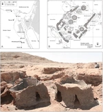
Before the establishment of the Kingdom of Judah, the region was inhabited by various Canaanite tribes. Archaeological findings indicate that these Canaanite communities practiced urbanization, agriculture, and trade. For instance, the site of Tel Dan, located in the northern part of ancient Israel, has yielded evidence of Canaanite occupation, including city gates and fortifications dating back to the Middle Bronze Age (c. 2000–1550 BCE). These developments laid the groundwork for the emergence of Israelite culture in the region.
By the Late Bronze Age (c. 1550–1200 BCE), the Canaanite city-states began to decline, possibly due to invasions and internal upheavals. This period saw the gradual infiltration and settlement of groups identified as Israelites. Archaeological evidence from sites such as Khirbet Qeiyafa and Khirbet al-Ra'i suggests that these early Israelite settlements were characterized by fortified structures and distinct pottery styles, indicating a move toward centralized organisation and state formation.
- As evidence of the early stage of this period, let us consider three main sites, carefully and thoroughly examined up to the present time.
🌇 Khirbet Qeiyafa
- Located in the Elah Valley, Khirbet Qeiyafa is one of the most significant archaeological sites associated with early Judah. Excavations have uncovered a fortified city with casemate walls, a city gate, and a large public building, all dating to the early 10th century BCE. The site's strategic location and architectural features suggest it served as a military outpost or administrative centre during the reign of King David.
🌇 Khirbet al-Ra'i
- Situated near Khirbet Qeiyafa, Khirbet al-Ra'i provides additional insights into early Judahite society. Artifacts from this site include pottery and inscriptions that align with the material culture of the period, supporting the notion of a developing Judahite identity distinct from neighboring cultures.
🌇 Lachish
- The site of Lachish, mentioned in biblical texts, has yielded evidence of fortifications and administrative structures dating to the late 10th century BCE. These findings corroborate the biblical account of King Rehoboam's fortification efforts and the expansion of Judah's territory during this period.
But to be crystal fair, we should note, that the Tel Dan Stele, an Aramaic inscription dating to the 9th century BCE, contains the phrase 'House of David' providing the earliest known extrabiblical reference to King David. Such inscriptions are crucial for understanding the historical context and confirming the existence of key figures mentioned in biblical narratives.
The Settlements And Structure Of Early Israelites
Early Israelite society was primarily agrarian and organized around extended family units. Archaeological evidence indicates that Israelites lived in nuclear households, often clustered in small villages. These homes were typically constructed with mudbrick and stone, featuring multiple rooms and sometimes a second story. The layout often included a courtyard for domestic animals, reflecting a subsistence economy based on agriculture and pastoralism. Villages were situated in the central hill country, an area less influenced by neighboring urban centres, which contributed to the development of a distinct Israelite identity.
During the period of the Biblical Judges, Israelite society lacked a centralized monarchy and was instead organized into tribes led by judges. These leaders were often charismatic figures who arose in times of crisis to deliver the Israelites from oppression. Over time, the desire for a centralized leadership led to the establishment of the monarchy, beginning with King Saul. The king's role was to unify the tribes, lead military campaigns, and establish a centralized administration.
Did they have a communal measurement system at this period? Indeed, they did. We will trace the origins of that system later; for now, let us continue describing the socio-cultural background. In the next section, devoted to their written tradition, we will begin to follow the object of our primary interest.
Speculations Of The Hebrew Language Origin, But Not Only Speculations...
First of all, let us glance at the evidence that brings context to the discussion:
- Khirbet Qeiyafa Ostracon (c. 10th century BCE): A pottery shard inscribed with five lines of text, possibly reflecting an early form of the Hebrew language. Its exact linguistic classification remains debated.
- Gezer Calendar (c. 10th century BCE): A limestone tablet listing agricultural activities, providing insights into the seasonal life of the Israelites.
- Tel Zayit Abecedary (c. 10th century BCE): A limestone boulder inscribed with a complete Phoenician alphabet, marking a significant stage in the development of alphabetic writing.
- Siloam Inscription (c. 8th century BCE): A Hebrew inscription found in the Siloam Tunnel in Jerusalem, commemorating the tunnel’s construction during King Hezekiah’s reign.
- Ketef Hinnom Scrolls (c. 7th century BCE): Silver amulets inscribed with portions of the Priestly Blessing, among the oldest known biblical texts.
The artefacts listed above show that the development of Hebrew writing evolved from the Phoenician script—a derivative of the Proto-Canaanite alphabet.
The origins of the Hebrews are complex and multifaceted, with several theories regarding their emergence:
- Indigenous Development: Some scholars propose that the Hebrews were native to the central hill country of Canaan, gradually forming a distinct identity through cultural and religious practices.
- Canaanite Continuity: Genetic studies indicate that modern Jewish and Arab populations of the region share significant ancestry with ancient Canaanites, suggesting continuity and assimilation over time.
- Exodus Tradition: The biblical account of the Exodus describes the Hebrews’ migration from Egypt to Canaan. While archaeological evidence for this event remains limited, it continues to hold central importance in Hebrew identity and history.
❗ Metrology and measurement systems have always advanced alongside writing systems. Here, it is important to emphasize that the Israelites employed a numerical structure based on the decimal system, similar to other ancient Near Eastern cultures. This system was used in various aspects of daily life, including trade, agriculture, and religious observance. Inscriptions from the period, such as those found at Tel Arad, indicate that the Israelites possessed a sophisticated understanding of time and numerical organisation, as evidenced by references to months and days in their records.
Here the author found appropriate place to list The Kings of ancient Israel State, and finalize the section with its measurement system...
The Kings of the Kingdom of Israel — The House of David (Formally)
A brief account of the Crown’s representatives presented as a chronological overview of the kings of the Kingdom of Judah, from its establishment in the 10th century BCE until the Babylonian conquest in 586 BCE. This timeline includes the duration of each king’s reign, their character as depicted in biblical narratives, and the notable events that occurred during their rule.
1.👑 Rehoboam (c. 931–913 BCE):
- Reign: 17 years, Character: Generally considered a 'bad' king, Notable Events: His harsh policies led to the division of the united monarchy; the northern tribes rebelled, forming the Kingdom of Israel
2.👑 Abijah (Abijam) (c. 913–911 BCE):
- Reign: 3 years, Character: Labeled as a 'bad' king, Notable Events: Engaged in a battle against Jeroboam of Israel; his reign was marked by continued conflict with the northern kingdom.
3.👑 Asa (c. 911–870 BCE)
- Reign: 41 years, Character: Regarded as a 'good' king, Notable Events: Instituted religious reforms, removed idols, and sought alliances to strengthen Judah
4.👑 Jehoshaphat (c. 870–848 BCE):
- Reign: 25 years, Character: Considered a 'good' king, Notable Events: Strengthened Judah's defenses, promoted religious education, and formed alliances with Israel
5.👑 Jehoram (c. 848–841 BCE):
- Reign: 8 years, Character: Viewed as a 'bad' king, Notable Events: Married Athaliah, daughter of Ahab of Israel; his reign was marked by internal strife and external threats
6.👑 Ahaziah (c. 841 BCE):
- Reign: 1 year, Character: Considered a 'bad' king, Notable Events: Aligned with Israel's King Jehoram; killed by Jehu during Jehu's coup in Israel
7.👑 Athaliah (Queen) (c. 841–835 BCE):
- Reign: 6 years, Character: Often labeled as a 'bad' ruler, Notable Events: Usurped the throne after the death of her son Ahaziah; her reign ended when she was overthrown by Jehoiada the priest
8.👑 Joash (Jehoash) (c. 835–796 BCE):
- Reign: 40 years, Character: Initially a 'good' king, Notable Events: Restored the Temple; later turned to idolatry, leading to his assassination by his officials
9.👑 Amaziah (c. 796–767 BCE):
- Reign: 29 years, Character: Mixed; 'good' early, but later actions led to his downfall, Notable Events: Defeated Edom; later turned to idolatry, leading to his assassination
10.👑 Uzziah (Azariah) (c. 792–740 BCE):
- Reign: 52 years, Character: Generally regarded as a 'good' king, Notable Events: Expanded Judah's territory; his later years were marked by pride and punishment
11.👑 Jotham (c. 750–735 BCE):
- Reign: 16 years, Character: Considered a 'good' king, Notable Events: Strengthened Judah's defenses; his reign was overshadowed by his father's (Uzziah's) earlier actions
12.👑 Ahaz (c. 735–715 BCE):
- Reign: 20 years, Character: Labeled as a 'bad' king, Notable Events: Introduced idolatry; sought Assyrian assistance, leading to Judah becoming a vassal state
13.👑 Hezekiah (c. 715–686 BCE):
- Reign: 29 years, Character: Regarded as a 'good' king, Notable Events: Instituted religious reforms; successfully resisted Assyrian siege of Jerusalem
14.👑 Manasseh (c. 687–642 BCE):
- Reign: 55 years, Character: Initially a 'bad' king; later repented, Notable Events: Reversed his father's reforms; later sought repentance and attempted reforms
15.👑 Amon (c. 642–640 BCE):
- Reign: 2 years, Character: Considered a 'bad' king, Notable Events: Continued idolatry; assassinated by his own servants
16.👑 Josiah (c. 640–609 BCE):
- Reign: 31 years, Character: Regarded as a 'good' king, Notable Events: Instituted major religious reforms; killed in battle against Pharaoh Necho II
17.👑 Jehoahaz (Shallum) (c. 609 BCE):
- Reign: 3 months, , Character: Labeled as a 'bad' king, Notable Events: Deposed by Pharaoh Necho II; taken to Egypt
18.👑 Jehoiakim (c. 609–598 BCE):
- Reign: 11 years, Character: Considered a 'bad' king, Notable Events: Initially a vassal of Egypt; later submitted to Babylon; faced internal unrest
19.👑 Jehoiachin (Jeconiah) (c. 598–597 BCE):
- Reign: 3 months, Character: Viewed as a 'bad' king, Notable Events: Deported to Babylon during Nebuchadnezzar's siege
20.👑 Zedekiah (c. 597–586 BCE):
- Reign: 11 years, Character: Considered a 'bad' king, Notable Events: Rebelled against Babylon; Jerusalem was besieged and destroyed; he was captured and taken to Babylon
And here we may finalize the story of the Israelite Crown, but…
The Restoration of the Reign over the Kingdom of Israel
Post-Zedekiah: Babylonian Exile & Persian Period
- 586–538 BCE: Judah ceased to exist as a kingdom. The region became a Babylonian province, and much of the elite population was exiled (Babylonian Captivity).
- 538 BCE: King Cyrus the Great of Persia conquered Babylon and allowed the exiles to return. This is the start of the Second Temple period.
- No native monarchy: Upon return, Judah did not reestablish a Davidic king. Instead, governance was handled by: Persian-appointed governors (e.g., Zerubbabel as governor). High priests (religious and partial civil authority). Native elites: The returned Judahites (Zerubbabel, Joshua the High Priest, and others) formed the ruling local elite under Persian oversight. This system continued under Hellenistic rule and later under Roman client administration.
Later history flow gradualy showing us the decaying of social structures, and as a result, unevoidble falure of the state as is:
Roman Period (63 BCE onwards)
- Client kings: Rome reintroduced local kings, but these were Roman-appointed representatives, not fully sovereign rulers: Hasmonean dynasty became a client kingdom initially.
- Herod the Great (37–4 BCE) ruled as a Roman-appointed king. Herod’s successors ruled divided client territories.
- No restoration of full Davidic sovereignty: The monarchy under Rome was essentially symbolic and administrative, with real power held by Rome.
The Measurement Units and Their Historical Value
If you have read carefully — with no mercy to skip the lateral influences upon the Judaic state culture from neighboring civilisations or their eventual impacts — we may now trace the units themselves and attempt to uncover the cultural influences behind them.
📏 Length and Distance Units
- Cubit (Amah):
Archaeological Evidence: The Siloam Inscription, dated to the 8th century BCE, mentions a length of 1,200 cubits for Hezekiah's tunnel. The tunnel's actual length is approximately 547 meters, suggesting a cubit length of about 45.75 cm.
- Handbreadth (Tefach) and Finger (Etzba):
Archaeological Evidence: While direct archaeological evidence for these units is limited, their use is inferred from biblical texts. For instance, the dimensions of the Tabernacle and its furnishings in Exodus are described using these units.
⚖️ Weight Units
- Shekel:
Archaeological Evidence: A stone weight inscribed with the word 'beka' was discovered near the Western Wall in Jerusalem. This weight is associated with the biblical half-shekel tax.
- Mina:
Archaeological Evidence: The weight system in ancient Judah was influenced by the Babylonian system, where the mina was a standard unit. Archaeological finds, such as weights and inscriptions, indicate the use of the mina in trade and temple offerings.
- Talent:
Archaeological Evidence: The talent, a large unit of weight, is mentioned in the construction of the Tabernacle in Exodus 38:24. Archaeological findings, including inscriptions and weights, confirm its use in large-scale transactions and offerings.
🧊 Volume Units:
- Ephah and Bath:
Archaeological Evidence: Inscriptions from sites like Tell Qasileh and other Judahite locations have been found with markings indicating the ephah and bath. These units were used for measuring grain and liquids, respectively.
- Seah, Hin, Omer:
Archaeological Evidence: These smaller volume units are mentioned in biblical texts and are inferred to have been used in daily life for measuring grain and liquids. Direct archaeological evidence is limited but supported by textual references.
Length Units Of Israel Kingdom
Unit
Archaeological Evidence
Estimated Length
Modern Equivalent
Cubit (Amah)
Siloam Tunnel inscription (~8th c. BCE), Judahite building remains
~0.457 m
1 cubit ≈ 0.457 m
Handbreadth (Tefach)
Inferred from cubit (Tabernacle dimensions)
~0.114 m
1 handbreadth ≈ 0.114 m
Finger (Etzba)
Inferred from handbreadth
~0.019 m
1 finger ≈ 1/6 handbreadth ≈ 0.019 m
Mile (Mil)
Persian-influenced units, used in late Judahite period
~1,609 m
1 biblical mile ≈ 1.609 km
Weight Units Of Israel Kingdom
Unit
Archaeological Evidence
Estimated Weight
Modern Equivalent
Gerah
Stone weight found in Jerusalem
~0.57 g
1 gerah ≈ 0.57 g
Shekel
Temple tax weights, First Temple period
~11.4 g
1 shekel ≈ 11.4 g
Bekah
Half-shekel stone weight
~5.7 g
1 bekah ≈ 5.7 g
Mina (Maneh)
Babylonian-influenced weights, inscriptions
~574 g
1 mina ≈ 574 g
Talent (Kikkar)
Large temple/treasury weights
~34.4 kg
1 talent ≈ 34.4 kg
Volume Units Of Israel Kingdom
Unit
Archaeological Evidence
Estimated Volume
Modern Equivalent
Log
Temple jars, ritual measurements
~0.3 L
1 log ≈ 0.3 L
Hin
Inscriptions at Judahite sites
~3.7 L
1 hin ≈ 3.7 L
Bath
Temple vessels (Solomon’s Temple)
~22 L
1 bath ≈ 22 L
Seah
Inferred from ephah
~7.3 L
1 seah ≈ 7.3 L
Ephah
Storage jars, grain measurements
~22 L
1 ephah ≈ 22 L
Omer
Manna portion, pottery inscriptions
~2.3 L
1 omer ≈ 2.3 L
Sources are based on archaeological findings: Siloam Tunnel measurements, First Temple–period weights, storage jars, and inscriptions from Jerusalem, Lachish, Tel Arad, and related Judahite sites. These measurements represent averages, as exact standards varied slightly over time. Area units are inferred from agrarian practices (e.g., the ephah of grain sown per plot).
As you may notice, we have passed through the culture and reached the topic we were concerned about. Yet our journey through the cultures and their measurement systems has not even crossed the equator of the narration. So, for now, let us take a coffee break — and then we will meet you again at the Assyrian Kingdom, where we will explain why that culture was chosen by the authors.
Ordinarity and regularity are not what you expect from us, right? Correct — but please, be respectful of the environment: from coffee cups to baskets, dispose of them properly! (You remember, there was a coffee break...)
This Chapter Devoted To Two Cultures, Babylonia And Persia, Below We Uncover Why
As well known, both of the mentioned giant states greatly impacted the Israelite Kingdom, and that is the reason we are turning our view toward them.
The two cultures most deeply interwoven with the later life of the Israelite (Judah) Kingdom shaped its politics, economy, religion, and even its metrology.
Here we will try to give a preview of how their influences layered upon Israel’s destiny — then we will dive into each culture’s specifics, as the deterministic background of their metrology (as we love to do).
🏰 Babylon — The Conqueror and Cultural Imprint
The timeline of the period we are discovering is about 620–539 BCE, under the figures well known to us from school — Nebuchadnezzar II and Nabonidus (unknown? see the link below to learn more: Nebuchadnezzar II, Nabonidus — see more).
The land of Israel was conquered under the direction of these two brave figures, accompanied by Babylonian brutality, through the destruction of Jerusalem (586 BCE) and the First Temple, and the deportation of Judah’s elite. This event didn’t merely shatter statehood — it standardized Israelite knowledge through Babylonian scribal and metric systems.
Some innovations were also imposed upon the Israelite state (the remnants of it, of course). During this time, administrative standardisation took place: Aramaic script and Babylonian accounting tablets infiltrated Judean practices; ‼️ measurement units such as the shekel, mina, and talent became formalized with Babylonian ratio structures (the 60-based sexagesimal logic).
We are sure you’ve heard that the Israelites live with two calendar systems — the modern one (as we all use in our everyday life) and their own national one (more closely tied to Judaic religious tradition). Strictly speaking, this originated from the Babylonian lunisolar time-reckoning system, which replaced local calendars and shaped the evolution of the Hebrew calendar.
🏰 Persia — The Organizer and Restorer
- Timeline of this period is roughly 539–332 BCE. The rulers of the Achaemenid Persian period we discuss include: Cyrus the Great, Darius I, Artaxerxes I.
Impact: the conquest may be scored as mostly positive for the domestic population, including their social stratification (which was, by the way, restored). Cyrus’s decree (539 BCE) allowed Jewish exiles to return and rebuild the Temple — making Persia the first “liberator” power.
Surprisingly, we may find some positives in socio-evolutionary developments. Under the Achaemenid satrapal system, Judah (as Yehud Medinata) became a semi-autonomous province — politically subdued, yet culturally revived.
Of course, standardisation with the metropolitan measurement system was unavoidable under centralized power; as a consequence, Persia unified weights and measures — the Persian daric, siglos, and royal cubit — later absorbed into post-exilic Judean systems.
✏️ Not exactly, but in the spirit of cautious speculation, we may suppose that Zoroastrian dualism subtly influenced later Jewish theological developments, especially eschatology (good vs. evil, afterlife).
✏️ So this mixture of impacts leads us to some conclusions we cannot pass over here. The Judean world that emerged post-exile was a hybrid: Babylonian precision in metrics, astronomy, and trade; Persian bureaucratic order in governance and taxation; Judean theological resilience, transformed but unbroken — a culture surviving conquest through adaptation.
And this description significantly enriches the chapter about the Jewish Kingdom — and, yes, that is not all, which means, you are welcome!
Babylon, So legendary, As Mistificated
Babylon History
And here the place we should turning backward, to culture, already passed but under other angle.
Brief reminder:
❗ Sumerians — The Blueprint Civilisation. Timeline: ~4000–2300 BCE. Main Cities: Uruk, Ur, Lagash, Eridu, Nippur. Language: Sumerian (isolate, not Semitic).
- Innovation Level: unparalleled — the world’s first known systematized culture.
Key Achievements
- Writing: Cuneiform on clay tablets — enabling administration, contracts, measurements, astronomy. Mathematics: Invented the sexagesimal (base-60) system, which became the foundation for all Mesopotamian calculation. Metrology: Developed the first unified measurement system — for length, volume, and mass, including the Sumerian cubit (~0.497 m), mina, and shekel. Architecture & Surveying: Canal irrigation required precise geometry, giving rise to proto-engineering. Astronomy: Recorded celestial movements; early ziggurats were aligned astronomically.
Cultural Essence
- Sumerian worldview was technical and pragmatic — gods controlled nature, but humans controlled order.
That sense of order through measurement is the core legacy that Babylon inherited.
❗ Akkadian Empire — The Unifier. Timeline: ~2334–2154 BCE. Founder: Sargon of Akkad
- Language: Akkadian (Semitic). Significance: The first empire — merging Sumerian city-states under one crown.
Influence
- Adopted Sumerian science wholesale: cuneiform, mathematics, and metrology. Introduced Akkadian language administration — blending Sumerian numerals with Semitic grammar.
- Standardized weights and measures across Mesopotamia.
- Set the stage for later Babylonian governance — bureaucracy, archives, and codified law (early precedents of Hammurabi).
Old Babylonian Period — The Systematizers
As we have already seen, the Babylonian Kingdom did not arise in a vacuum — its very existence was shaped by historical inevitability. The following points will only emphasise these outcomes.
By the time of King Hammurabi of Babylon (r. 1792–1750 BCE), a well-developed linguistic model already existed — Akkadian, in its Babylonian dialect — which, under the king’s administration, was further refined and standardised for official use.
Under the king’s regulations, the so-called Code of Hammurabi was designed and promulgated. It served not merely as a legal text but also as a catalogue of standardised measures and values — covering grain, land, and labour.
The proto-scientific evolution of Babylonian thought led later generations to preserve and refine the Sumerian base-60 arithmetic, producing tables for squares, cubes, and reciprocals — a genuine form of proto-algebra, forming a structured body of knowledge for future advancement.
The metrological system, already well known by its names — Cubit (kuš) ≈ 0.497 m; Shekel ≈ 8.4 g; Mina = 60 shekels (≈ 504 g); Talent = 60 minas (≈ 30.2 kg); and the volume measures (gur, sila, ban) — formed the base units for grain and liquid trade.
Continuation of the Sumerian long-term celestial recordkeeping, but with systematisation for calendrical use.
A vast amount of our contemporary knowledge base about Sumerian civilisation is owed to Babylonian records.
Now Time Of Units?, So, Follow Us...
Babylonian Units Of Length
Unit
Approx Equivalent
Notes / references
Cubit (kuš / ammatu / ammûtu)
~ 0.50 m
In Neo-Babylonian texts the cubit is given ~ 0.5 m.
1/24 cubit (šu-si / ubânû)
~ 0.0208 m
As a fractional subdivision: cubit ÷ 24 ≈ 0.5 m / 24 ≈ 0.0208 m
gi / qânu (length unit = 7 cubits)
~ 3.5 m
7 × cubit (~0.5 m) = ~3.5 m
Length “GAR” unit (14 cubits)
~ 7 m
14 × cubit ≈ 7 m
Babylonian Units Of Area (Superficy, land measurement)
System
Units & Conversion
Approx Area in m²
Reed (small units)
e.g. kuš × kuš etc.
e.g. 7 sq. cubits ~ 1.75 m²
Seed / larger system
e.g. ban, gur of area
e.g. gur area ≈ 13,500 m²
Babylonian Units Of Weight (Mass)
Unit
Ratio / Relation
Approx Metric Equivalent
Notes / references
Grain (še / uḫṭatu)
base very small unit
~ 0.0000466 kg (≈ 46.6 mg)
Based on average of artefacts from Ur & Nippur
Shekel (šiqlu / gin₂)
1 shekel = ~ 8.40 g
~ 0.00840 kg
Standard in Mesopotamian tables
Mina (manû)
60 shekels
~ 504 g
60 × 8.40 g = ~504 g
Talent (bītu / biltu / gun₂ / kakaru)
60 minas
~ 30.2 kg
60 × 504 g = ~30.2 kg
Babylonian Units Of Volume
Unit
Relation / Multipliers
Approx Metric Equivalent
Notes / references
sila₃ / qa
base volume unit
~ 1 litre
The “sila” is often equated with about 1 L in Mesopotamian reconstructions.
ban₂ (sūtu)
6 × sila
~ 6 L
6 × 1 L = 6 L
PI / pānu
6 ban₂ = 36 L
~ 36 litres
6 × 6 L = 36 L
gur / kurru
5 × PI = 180 L
~ 180 litres
5 × 36 L = 180 L
These conversions are approximate — ancient measures varied over regions and epochs.
- Babylonian (Neo-Babylonian) systems often preserved and used older Sumerian standards.
- Volumetric capacity units often were tied to water weight equivalences, so a sila ≈ 1 litre is a standard working assumption.
When We Spelling Persia...
The cultural background of Persia has its roots in the Assyrian Kingdom, and a brief overview will reveal the socio-cultural intercrosses and inheritance from them.
Since they (Assyria & Persia) form the next decisive link after Babylonia in the continuum of ancient Near Eastern civilisation.
The attentive reader will note: the first millennium BCE is roughly interwoven with civilisations where one falls — with its achievements — to another, and in this game all the actors of that time play their part.
On the scene — Assyrians. Before Persia rose, Assyria dominated Mesopotamia. Its capital centres (Ashur, Nineveh, Kalhu/Nimrud) developed a highly bureaucratic empire.
🏰 The Assyrians inherited and refined Babylonian administrative and metrological systems:
– Standardized weights (shekel, mina, talent).
– Length units (cubit, double-cubit) aligned to the Babylonian base-60 structure.
– Military and irrigation engineering required precise volumetric measures (for grain, oil, and building material).
The Assyrian state was organized into royal provinces with governors (šaknu), tax registries, and temple-based archives. Their bureaucratic model directly inspired later Achaemenid administration.
🌱 Pre-establishing the Persian Kingdom (before 550 BCE):
The Persian tribes originated from the Indo-Iranian migrations (second millennium BCE). By the late 8th century BCE, they settled in Parsa (modern Fars) under Median suzerainty. The key tribes mentioned by Herodotus and cuneiform sources:
– Pasargadae — the leading tribe (Cyrus II’s lineage).
– Maraphii and Maspii — allied noble houses.
– Minor related groups: Cossaeans, Sagartians, and Elymaeans.
Culturally, early Persians merged Iranian nomadic traditions with Elamite and Mesopotamian administrative systems — creating a syncretic foundation for the Achaemenid Empire.
🏰 The Achaemenid Persian Kingdom (c. 550–330 BCE)
Would propperly to search upon the Society structure of the state. Under Cyrus the Great, the empire unified the Medes, Elam, and Mesopotamia. Darius I later institutionalized satrapy system — regional governorships (20–30), each with taxation quotas, royal roads, and garrisons.
As important part of data transmission established royal postal service and the Royal Road (Susa–Sardis, ~2700 km). Tri-lingual administration (Old Persian, Elamite, Akkadian), of course was not extremely convenient for state management, but was necessary approach for transitional period of the language unification, from the political point of view.
As any moderately developed society, stratification seated its place within the social organisation. We may subdevide them to: royal family and nobility (court aristocracy), military elite (the “Immortals” regiment), clerical and scribal class (Elamite and Aramaic scribes), and commoners and artisans.
Provincial populations maintaining cultural autonomy under tribute obligations.
Religion revolved around Zoroastrianism, emphasizing ethical dualism (Asha vs. Druj) and influencing state ideology — “king by the grace of Ahura Mazda.”
Time To Units...
Here we will provide a comparative table indicating the origins of the units and their implementations within the kingdom.
Persian Units of Length
Unit
Source
Approx. Modern Equivalent
Notes
Cubit (Arš)
Babylonian
≈ 0.525 m
Used for construction and architecture.
Parasang
Median/Iranian
≈ 5.5 km
Standard for travel and military distance.
Persian Units of Area
Unit
Source
Approx. Modern Equivalent
Notes
Bow-shot (plethron-like)
Iranian-Greek cross-use
≈ 0.04 ha
Land measurement in taxation.
Persian Units of Weight
Unit
Source
Approx. Modern Equivalent
Notes
Shekel
Babylonian legacy
≈ 8.4 g
Silver-based trade unit.
Mina
60 shekels
≈ 504 g
Administrative weight.
Talent
60 minas
≈ 30.2 kg
Imperial treasury standard.
Persian Units of Volume
Unit
Source
Approx. Modern Equivalent
Notes
Artaba (For Dry)
Persian
≈ 51 L
Used for grain; basis for later Hellenistic modius.
Homer-like jar (For Liquid)
Mesopotamian
≈ 220 L
Used in royal storehouses.
Persia stood out from all its predecessors as a prime pattern of an empirical approach to all conquered territories, and these principles we may generalize to several thesis.
- Efficient taxation and uniform weights/measures.
- Infrastructure: canals, roads, and postal relays.
- Cultural diffusion: from Indus to Aegean — their metrology later influenced Greek, Seleucid, and Islamic systems.
But, as with any invention, its childish concerns and underestimated errors contributed to the downfall of the proto-empire. Empires always die...
We have passed through many cultures, and the globe still shows no end. Our journey continues — this time, the milestone before us points toward the land of the great pastoral banks of the Indus River.
As you are feeling, the time of socio-cultural background will describe the Indus region, replacing the Mediterranean lands.
The Shores Of The Ind River, And His Brother The Gung River Are Calling Us!..
Indus Valley
The area of the region scattered widely from the Iran–Pakistan coast in the west to near modern Delhi in the east, and into Afghanistan to the north.
But the tribal sites were founded mostly along the Indus River basin shores, and these are exactly the core object of our review now.
For generalisation purposes, we may divide the region into eight sectors, each of them possessing its own uniqueness — both territorial and chronological.
Let us encounter them one by one, in such a manner as the rivers, never hurrying in their flow, and with respect to the greatness of the landscape we shall be crossing over.
🏕️ Baluchistan Highlands (Mehrgarh and Associated Valleys)
Sites on the territory: Mehrgarh (Kachi Plain), Kili Gul Mohammad, Nausharo, Mundigak (Afghan border).
The archaeological sources discovered the settlements:
- Early domestication of wheat, barley, and zebu cattle (proposed by researchers, speculative).
- Mud-brick houses with multiple rooms (speculative, but possible).
- Burial sites containing ornaments made of lapis lazuli, turquoise, and marine shells (evidence of trade links).
- Early copper tools and bead-making workshops.
The population here represented early agro-pastoral communities, sometimes identified with pre-Dravidian or proto-Indus substrata. The Mehrgarh culture is regarded as the cradle of South Asian Neolithic life, transmitting farming knowledge eastward to the Indus plains (indirect position of researchers, mostly).
The period of the sites we reviewed is framed as 7000–3300 BCE.
- Settlements: Harappa, Kot Diji, Kalibangan I (early phase), Jalilpur.
Fundament for our speculation (sometimes about real archaeological artefacts):
- Development of mud-brick walled towns, small citadels, and grain storage (suggested, indirect).
- Handmade pottery with geometric motifs (real artefacts).
- Discovery of terracotta bull figurines, plough marks (Kalibangan), and seed remains showing organised agriculture (speculative suggestion, but as a theory has the right to be considered).
- Increasing standardisation of brick sizes and proto-writing marks on pottery (derivations from the artefacts, very probable to be true).
- Associated with the Kot Diji culture, possibly descended from Mehrgarh settlers who migrated eastward. This region likely included riverine agricultural clans and trade groups linking hill and plain (derivations based on generalised complex research).
🏕️ Sindh and the Lower Indus Basin
The period under review here is 3500–2600 BCE.
- Settlements under review: Amri, Mohenjo-daro (early levels), Chanhu-Daro, Kot Diji (southern type).
- Sources and speculations to list include pottery with painted patterns and wheel-made ceramics.
- Early fortified towns with planned street grids.
- Copper tools, shell ornaments, and faience objects.
- Increasing use of standardised weights and early trade with southern Mesopotamia (Dilmun–Ur) (derivations and suggestions based on artefacts).
All listed above encourage us to the outcome known as the Amri–Nal cultural horizon in its early phases. The tribal identity is uncertain but likely related to proto-urban trade groups developing long-distance connections. Their descendants evolved into the core urban population of Mohenjo-daro.
🏕️ Ghaggar–Hakra (Sarasvati) Region — Eastern Indus Fringe
Maybe it looks inconsistent with the timing, but we are not chasing date consistency; we are just walking the rivers’ shores, site by site. So now the period we are discovering in the region is dated as 3800–1900 BCE.
- The spots we found here are: Kalibangan I–II, Bhirrana, Banawali, Rakhigarhi.
- And what about the artefacts researchers supply us with? Early farming villages growing into towns along the dried Ghaggar–Hakra (often identified with the mythical Sarasvati River). And this assertion has a place to be alive, based on the following evidence.
- Kiln-fired brick architecture and grid-like layouts, seals, weights, and bead workshops of semi-precious stones (agate, carnelian) (partially derived from the excavations, but logically acceptable).
Continuous occupation from pre-Harappan to mature Harappan times (this is an absolutely disputable claim).
And now it is time for fantasy. The region reveals continuity from the Sothi–Siswal culture, possibly small farming clans who later integrated into the greater Indus network. They played a major role in maintaining the eastern trade and agricultural frontier.
🏕️ Gujarat, Kutch, and Saurashtra Peninsula
The timing turns us to the 3700–1900 BCE epoch, and there were Dholavira, Lothal, Rangpur, Surkotada, Kuntasi, and Loteshwar settlements. Of course, the names are in our modern reconstructed spelling, but that is what we have.
The evidence gives us the following: fortified towns with reservoirs and water-management systems (notably Dholavira). Evidence of salt extraction, shell processing, and maritime trade — surely hypotheses, but nevertheless may be considered as well-balanced arguments of human activity of the inhabitants of these sites.
- Early use of stone weights and proto-script marks derived from the excavated artefacts.
- Lothal’s dockyard indicates international commerce with the Persian Gulf.
- From all the above we may suggest that this region hosted the Anarta and Sorath traditions, representing local adaptation to the dry coastal ecology. Populations were skilled in trade and seafaring — likely proto-Dravidian speakers or coastal merchant tribes.
🏕️ Rajasthan and the Ahar–Banas Cultural Zone
The period, archaeologically dated to 3000–1500 BCE, and the artefacts show us the pastoral sites of Ahar, Gilund, and Balathal.
- What do the excavated remains uncover for us?
- Chalcolithic settlements with copper tools, wheel-made pottery, and mud-brick platforms as artefacts; and from the evident derivations, we may conclude that these are agricultural sites showing evidence of barley, lentil, and rice.
Speculation, as our distinctive fashion dictates? The Ahar–Banas culture was semi-independent yet interacted with the Harappans through trade. Tribes here controlled copper resources and supplied materials northward. Some continuity is visible in later early-historic cultures of Rajasthan.
🏕️ Northern Frontier and Himalayan Foothills
- Our chronicle jumps to the 4000–1800 BCE period. The settlements recommended to us by archaeologists are Burzahom (Kashmir), Gufkral, Mandi, and Sarai Khola.
- The set of excavations and unearthed artefacts list the following evidence: pit dwellings, bone tools, hunting and fishing implements.
- Domestication of sheep, goats, and cereals (especially in Kashmir) may be supposed from the excavated finds.
- Interaction zones between Central Asian and Indian Neolithic groups may be supposed for these settlements, based on their location and artefacts.
- A speculative summary may also find its place here: populations possibly related to early Tibeto–Burman and Indo-Iranian movements. They maintained mountain trade links, bringing jade, turquoise, and obsidian southward.
🏕️ Central Indian Plateau and Deccan Neolithic (Peripheral Influence)
The timing related to the settlements period we are attempting to describe covers 2500–1500 BCE.
- The territory shows us, through discoveries by researchers, settlement spots such as Chirand, Inamgaon, Nevasa, and Daimabad.
- Scientists did great work to provide us with the evidence and outcomes about the life of the regional inhabitants of the mentioned period.
Neolithic to Chalcolithic farming villages using stone axes and copper tools serve as evidence of rice cultivation, cattle herding, and long-distance trade of beads and metals.
- Underscoring the facts and suggestions listed above, we conclude that Deccan populations were distinct but influenced by northern contacts. Daimabad yielded a bronze chariot sculpture, symbolically linking southern metallurgy with Indus artistic tradition.
Early Neolithic Indus Tribes
Here, the authors will show, in a systematic scientific way, how to build a theory, design a hypothesis, and then derive outcomes to set them as patterns, which, in the next stage of the research procedure, will undergo probing for their credibility.
So, we have a collection of cultures (no need to list them here—just glance at the paragraph above). And what should scientists do? From experience, scientists know that every creature localized within a specific territory acquires certain characteristics dictated by environmental factors. For example, the hippo is so shaped by the factors of its territory that there must be lakes with mud, swamps, shores rich in plants and grasses—mostly bushes—a temperature range within a defined frame, and other environmental conditions. Dramatically changing these conditions leads to a decrease in the species’ population and may even result in its extinction. These predispositions show us the schema for collecting data, generalizing it, and classifying it into sets of objects, which later provide the predictive power of the scientific approach.
Just as described above, let's classify the listed cultures. From the described cultural characteristics, we may generalize them into two main groups by their specialization of activity. These categories are: metal working (basic knowledge of metallurgy), agricultural basics, animal domestication, and the use of river fauna as a significant resource supplement.
Now, classification stage. Index 0 we set to Baluchistan Highlands. Each culture will be scored by its cumulative evaluation, where metal knowledge +2, domestication +1, agriculture +1, fishing +0.5. So for index 0, we score [0] = metal(+2), domestication(+1), trading(+2). Indus Upper Basin (index 1), [1] = domestication(+1), agriculture(+1). Sindh and the Lower Indus Basin (index 2), [2] = trading(+2), metal(+2), agriculture(+1), domestication(+1). Ghaggar–Hakra (Sarasvati) Region (index 3), [3] = domestication(+1), agriculture(+1), trading(+2). Gujarat, Kutch, and Saurashtra Peninsula (index 4), [4] = fishing(+0.5), trading(+2), agriculture(+1), domestication(+1). Rajasthan and the Ahar–Banas Cultural Zone (index 5), [5] = metal(+2), trade(+2), domestication(+1), agriculture(+1). Northern Frontier and Himalayan Foothills (index 6), [6] = fishing(+0.5), domestication(+1). Central Indian Plateau and Deccan Neolithic (index 7), [7] = metal(+2), trade(+2), agriculture(+1), domestication(+1).
Precalculation will reveal the following: [0]:5, [1]:2, [2]:6, [3]:4, [4]:4.5, [5]:6, [6]:1.5, [7]:6. And these score ratings we will call the developmental scale of proto-society.
This section is purely speculative content, aimed at showing the reader the classification and evaluation approaches, but it contains no real scientific facts. Below, we will explore the actual historical evolutionary processes of the territory and compare them with the predictions sketched here.
The Indus (Harappan) Civilisation
Transition from Mehrgarh to Early Harappan (c. 3500–2600 BCE)
After Mehrgarh’s late Chalcolithic period, the Kachi Plain and neighboring valleys (Nausharo, Mundigak, Damb Sadaat) developed into regional centres connected through trade and shared cultural traits.
The Indus (Harappan) Civilisation — The First Real “Statehood” (c. 2600–1900 BCE): Formation of the Mature Harappan State: by about 2600 BCE, cultural unification across Baluchistan, Sindh, Punjab, and northwestern India produced the first true state system in South Asia.
Baluchistan acted as the western wing of this civilisation. Sites like Nausharo and Mehrgarh (late phases) were part of the Harappan economic network, possibly supplying metals and minerals to the core Indus cities.
Collapse of the Harappan State (c. 1900–1300 BCE): The causes that led to the collapse may be listed as climatic aridification (drying of the Ghaggar–Hakra river system), decline in trade with Mesopotamia, and localization and fragmentation into smaller regional cultures (Late Harappan phase).
Cultural Successors in Baluchistan: Jhukar Culture (Sindh and Baluchistan) and Kulli Culture (southern Baluchistan, with fortified towns and local chiefdoms) both represented post-urban, ruralized kingdoms or chiefdoms with limited bureaucracy but clear elite presence.
After the Harappan world fragmented, Iranian and Indo-Aryan groups began to dominate the wider region. To the east (Punjab, Indus Basin), Indo-Aryan tribes formed janapadas—tribal proto-kingdoms that would later give rise to the Mahajanapadas of India. Baluchistan, being peripheral, oscillated between Iranian and South Asian cultural spheres.
The Indus (Harappan) Measurement System
It is time to introduce the cultural measurement system. To avoid fragmentation among the units, we choose exactly the c. 2600–1900 BCE (Mature Harappan Phase) period, and note that the system mainly developed from earlier regional practices (e.g., Mehrgarh and Early Harappan Amri–Kot Diji cultures).
As a classificative factor, we may assume that the system possessed the characteristics of being standardized and decimal (base 10 and 2 multiples), uniform across > 1500 km—from Harappa to Dholavira—showing central regulation, used for trade, taxation, architecture, and crafts, possibly one of the earliest known state-wide metric systems.
Before the units are presented, we should clarify some linguistic and cultural notes.
Continuity of ‘Karsha’ (≈ 13.6 g): The Arthaśāstra and early Buddhist texts use karsha or suvarna as a standard trade weight. Its mass (≈ 13.5 g) matches the Harappan base unit almost exactly—suggesting direct survival of the Harappan standard into early historic India (2,000 years later).
Binary + Decimal Progression: Harappan multiples followed binary expansion (× 2), while later Vedic/Mauryan systems used 16 masha = 1 karsha—another binary-derived (2⁴) pattern. This mathematical consistency hints that the Indus system shaped the logic of later South Asian metrology.
Absence of Script Names: Because Indus glyphs remain unread, scholars use descriptive labels (‘Harappan unit’, ‘chert cube Type A’) or retrofitted Indic names for teaching and comparison. The cultural transmission path may be ordered as Mehrgarh → Harappan → Late Harappan → Vedic → Mauryan administrative codification (Arthaśāstra). Each stage preserved both the mass ratios and binary progression.
Thousands of cubical stone weights found — usually of chert or steatite, highly polished, often with flat faces and precise ratios.
Standard Unit
Ratio
Approx. Metric Equivalent
Probable Later Equivalent (Indic / Dravidian)
Notes
Base Unit
1
≈ 13.7–14.0 g
karsha (Sanskrit); kaṟcu (Tamil)
Core unit; appears as “karsha = 16 masha” in later Vedic system; matches Harappan base precisely.
Double Unit
2
≈ 27–28 g
palā (Skt.) ≈ 2 karsha = ≈ 27 g
Likely equivalent to an early trade weight or artisan measure.
Quadruple Unit
4
≈ 55 g
ardha-prastha (Skt.) ≈ 54 g
Used in early Mauryan grain and metal measures.
Octuple Unit
8
≈ 110 g
prastha (Skt.) ≈ 108 g
Common later “merchant’s pound.”
16-unit
16
≈ 220 g
āḍhaka (Skt.) ≈ 216 g
Possibly the large market unit or tax assessment measure.
32-unit
32
≈ 440 g
droṇa / suvarṇa
Heavy trade weight, sometimes ritual use.
64-unit
64
≈ 880 g
bhāra (load, bundle)
Used for grain, copper ingots, or tithes; likely the upper administrative weight.
Derived from artifacts.
Ivory and shell rulers were discovered at Lothal and Mohenjo-Daro.
Architectural standardisation (e.g., brick sizes) reveals the same underlying unit.
Unfortunately, naming of the units cannot be provided due to a lack of data.
Standard Unit
Archaeological Evidence
Approx. Metric Equivalent
Derived From
Base Unit ('Indus foot')
Ivory scale marks, Dholavira city plan
≈ 33.5 cm
length between marked notches
Half Unit
on same scales
≈ 16.7 cm
used in small crafts
Decimal Subdivisions
lines on ivory scale show 10 sub-marks per unit
≈ 3.35 cm
decimal subdivision
Double Unit
brick dimensions (1 × 2 × 4 proportions)
≈ 67 cm
construction measure
The concept of the classification roughly aligns with archaeological evidence:
- Street widths, wall lengths, and granary modules conform to multiples of the ~33.5 cm unit.
This shows a modular concept of volume, paralleling the logic of their linear and weight measures.
Type
Est. Unit
Approx. Metric Volume
Evidence
Grain measure (jar type A)
1 Harappan measure
≈ 1.1 L
standardized pottery molds
Large storage bin
10–100 units
≈ 10–100 L
Harappa granary bins
City granary cells
module of ≈ 6 × 3 m × 1.5 m
≈ 27 m³ ≈ 27 000 L
used for taxation grain
The Indus River Shores
Application and Administration — Speculative Notations:
- Primary Uses: Trade accounting (weights found in markets and docks), craft workshops (bead-making, metallurgy), urban planning — brick and street modules imply central authority, possibly tax or tithe collection (granary evidence).
- The uniformity suggests a central metrological authority — possibly a “standard house” or temple bureau, similar to the Mesopotamian “House of Weights.”
Indus seals may encode metrological marks; some pictographs might represent standard values or commodity types.
The States Regional Diversity Of The Modern India Region
The Indus (Harappan) civilisation we exposed to our honorable reader above is only one of the socio-cultural phenomena established based on the region proto-cultures, and in this section we will meet you with number of them.
Each from states had its distinctive organisation structure, religy, and as result, own measurement system.
The kingdoms will be represented briefly, with notation of their general characteristics, language in use
So, go ahead!..
🏰 Kingdom of Mohenjo-Daro (Lower Indus Valley)
Location: Sindh, near the Indus River delta.
Ecology: Riverine and marshland environment with flood management needs.
Authority Type: Ritual-bureaucratic theocracy — priest-engineers controlling waterworks and sanitation.
Cultural Identity: Cosmopolitan; maritime trade contacts (Mesopotamia); extensive civic planning.
Language: Same script family, but likely a different dialect from Harappa; seal motifs richer in animal totems.
Distinctive Principle: Purity, water-control, and urban hygiene as sacred state duty.
🏰 Kingdom of Saraswati / Ghaggar–Hakra
Location: Haryana–Rajasthan–Cholistan; along the now-dry Ghaggar–Hakra River.
Authority Type: Military–frontier principality, protecting inland trade from nomads.
Cultural Identity: Smaller fort layout; horse remains (earliest India).
Language: Western dialect of Harappan family.
Distinctive Principle: Border defense, cavalry innovation, and customs control.
The authors allowed ourself compare the kingdoms with their main distinctions, appropriate at this stage of our cultural diving adventure...
These were distinct cultural and political regions, not uniform provinces.
Languages/dialects likely differed — all using the Indus script but representing multiple speech communities (Dravidian, Elamo-Dravidian, early Indo-Iranian).
Authority systems varied: some were ritual-theocratic (Saraswati, Mohenjo-Daro), others bureaucratic or commercial (Harappa, Lothal), and a few military or resource-based (Surkotada, Nausharo).
The federative unity came from shared standards — weights, brick ratios, and a symbolic ideology of order and purity.
Key Differences at a Glance For The Kingdoms
Region
Ecological Type
Authority Model
Cultural-Linguistic Emphasis
Harappa (North)
Fertile plains
Bureaucratic administration
Dravidian-structured language; script formalized
Mohenjo-Daro (South)
River delta
Ritual-theocratic
Cosmopolitan; maritime lexicon
Saraswati (East)
Semi-arid agrarian
Fire-priest monarchy
Proto-Vedic; ritual Sanskrit precursors
Dholavira (West)
Desert island
Hydraulic monarchy
Local dialect; emphasis on civic geometry
Lothal (Coast)
Maritime delta
Trade bureaucracy
Trade vocabulary; bilingual seals
Chanhu-Daro (Central Sindh)
Semi-arid plain
Guild administration
Industrial vocabulary; numeric notation
Amri–Nausharo (Frontier)
Highland fringe
Resource monarchy
Proto-Dravidian metallurgical lexicon
Surkotada (Border)
Desert frontier
Defensive principality
Military terminology; cross-cultural seals
Relations between the kingdoms
Relation type
Evidence & nature
Trade & economic exchange
Identical seals, weights, and brick ratios across 1 million km² show an inter-regional economic federation. Harappa exported finished goods south; Lothal handled overseas cargo; Dholavira controlled desert caravans; Nausharo supplied copper and stone.
Cultural & administrative communication
Same writing system, civic engineering style, and metrology suggest constant coordination — possibly annual meetings of priest-administrators or travelling merchants who kept standards uniform.
Diplomatic or religious unity
Shared iconography (the “unicorn” seal, Pashupati figure, water/animal motifs) implies a common symbolic order, like a confederation’s banner.
Competition & local rivalry
Fortifications, defensive bastions, and shifting trade routes point to commercial and territorial rivalries rather than large-scale war. Think of them as city-state competitors—much like Sumer’s Ur and Lagash.
Conflict scale
No evidence of empire-level conquest or organized warfare—no mass graves or burnt layers comparable to Near Eastern wars. Conflicts were likely economic blockades or brief raids.
Inter-kingdom communication
River and coastal routes linked all nine: Indus–Ravi–Sutlej–Hakra corridor inland, and coastal trade from Lothal/Dholavira down to Oman and up to the Persian Gulf.
Summarising the landscape of the territory, its habitants, historical evolutionary pathway, the only outcomes we may record:
- The Indus Civilisation functioned as a federation of nine regional kingdoms, each self-governing but bound by a shared technical and moral order: civic cleanliness, standard weights, and regulated exchange.
- No single “empire” ruled the rest; power was distributed, balanced through trade and shared ideology.
- Their system lasted six to seven centuries—longer than most Bronze-Age monarchies—because cooperation outweighed conquest.
Let's review the measurement systems, and its rates, for fulfill the gap of whitespace from cultural backgroud to its metrologycal approach.
in addvance we noting here some critical points, which loudly screaming for clarification, despite small regional offsets (±1 cm per cubit, ±1 % per weight), all nine kingdoms followed:
- Binary–decimal weight system based on ≈ 13.6 g.
- Linear cubit ≈ 33–34 cm, divisible into 30 sub-marks (~1.1 cm)
The Two Rivers Shores Here We Passed Over, And Time To Take A Break, Before We Leave The Indus Lands
This is section we will try to commulate all our creeks to single river flow of outcomes, prehistoric cultures, to kingdoms, and assuming, was our predictions, based on incomlete and may be speculative scoring method succeed?
From Neolithic–Chalcolithic Cultures → Indus Kingdom System (7000–1900 BCE)
→ Deccan Bronze traditions; later Satavahana core region
Influenced by Indus metallurgy but not politically part of the federation.
Alignment of Cultures with the Nine Indus Kingdoms
Indus Kingdom
Root Culture(s)
Degree of Continuity
Result
Harappa
Kot Diji, Ravi Phase
Direct, full
Urban bureaucratic heartland
Mohenjo-Daro
Amri–Nal Horizon
Strong
Major southern capital; maritime trade core
Saraswati / Ghaggar–Hakra
Sothi–Siswal / Early Kalibangan
Direct
Eastern ritual-hydraulic monarchy
Dholavira
Anarta + Sorath
Full regional evolution
Desert-island hydraulic monarchy
Lothal
Anarta + Sorath
Full
Port-mercantile kingdom; maritime federation
Surkotada
Sorath extension
Direct
Frontier fort and military kingdom
Chanhu-Daro
Amri–Nal
Strong
Industrial guild city-state
Amri
Amri–Nal Early
Continuity
Proto-urban fort kingdom
Nausharo–Mehrgarh
Mehrgarh Highland Culture
Direct
Highland resource kingdom; earliest roots of Indus society
Cultures that vanished entirely (From Prehistoric Period)
Culture
Reason for disappearance
Outcome
Kili Gul Mohammad / Mundigak
Trade routes shifted east; isolation after 2600 BCE
Abandoned, absorbed by Indus highlands
Amri–Nal (as independent)
Integrated into wider Indus trade system
Lost independence, traditions persisted in pottery
Sothi–Siswal (as separate)
Merged under Saraswati urbanism
Absorbed into eastern Indus ritual states
Cultures that survived or transmitted influence
Culture
Later manifestation
Ahar–Banas
Copper trade continued into Early Vedic Rajasthan cultures
Anarta & Sorath
Persisted in Dholavira–Lothal crafts into Late Harappan (down to ~1700 BCE)
Deccan Chalcolithic
Continued independently; linked to Daimabad bronze tradition (~1500 BCE)
Burzahom–Gufkral
Survived as pastoral-agricultural upland cultures until Iron Age; possible Indo-Aryan interface
And now it is time to check our prediction scores from the beginning:
Totally vanished cultures we found here (based on facts), indexed within our predictions as:
- [0](Kachi Plain, Bolan Pass, Quetta, and Afghan border regions), we scored this culture with +5
- [1](Indus Upper Basin (Punjab Region – Ravi, Beas, Sutlej Rivers)), we scored it with 2
- [2](Sindh and the Lower Indus Basin), our evaluation for success in consecutive development +6
- [3](Ghaggar–Hakra (Sarasvati) Region — Eastern Indus Fringe), we scored these tribes with 4
- [4](Gujarat, Kutch, and Saurashtra Peninsula (Dholavira, Lothal, Rangpur, Surkotada, Kuntasi, Loteshwar, Nagwada, Bagasra)), in our prediction rated with 4.5
- [5](Rajasthan and the Ahar–Banas Cultural Zone (Ahar, Gilund, Balathal, Ojiyana, Bagor (earlier Neolithic))), we rated the culture with 6
- [6](Northern Frontier and Himalayan Foothills (Burzahom, Gufkral (Kashmir), Mandi (Himachal), Sarai Khola (Potwar Plateau, N. Pakistan), Loebanr, Ghaligai (Swat Valley))), we rated their potential as 1.5
- [7](Central Indian Plateau and Deccan Neolithic (Chirand (Bihar, eastern fringe), Inamgaon, Nevasa, Daimabad, Tekwada, Kayatha, Navdatoli (Madhya Pradesh and Maharashtra regions))), our estimation scored 6
Below we will present the table with reality data and our prediction. If our prediction rate is lower than 3, the tribe should not have survived; otherwise, we set a green V as a partially adaptable score. Conversely, if a tribe vanished but we scored a high value, it is considered a misprediction.
Scores Predictions Summary
index
rate
period
tribe
fate
success/unsuccess
[0]
5
7000–3300 BCE
Mehrgarh (Kachi Plain)
Survived and transformed
✅
[0]
5
3300–2600 BCE
Nausharo
Fully survived (absorbed)
✅
[0]
5
6000–3500 BCE
Kili Gul Mohammad (near Quetta)
Vanished / absorbed
❌
[0]
5
5000–3000 BCE
Mundigak (southern Afghanistan)
Vanished independently
❌
[1]
2
4000–2600 BCE
Kot Diji
Transformed → Survived
❌
[1]
2
3500–2800 BCE
Ravi Phase (Harappa I levels)
Fully survived
❌
[1]
2
3500–2800 BCE
Kalibangan I (early phase)
Merged eastward
❌
[1]
2
4000–3000 BCE
Jalilpur
Vanished / absorbed
✅
[2]
6
3600–2600 BCE
Amri–Nal Horizon (Sindh–Baloch border)
Transformed → Survived
✅
[2]
6
2600–1900 BCE
Mohenjo-Daro (DK-G, DK-A, HR areas)
Fully survived (until late Harappan)
✅
[2]
6
2600–1900 BCE
Chanhu-Daro
Survived partially (industrial)
✅
[2]
6
3500–2600 BCE
Kot Diji (southern)
Merged upward
✅
[2]
6
1900–1500 BCE
Jhukar Culture (Late Harappan, post-1900 BCE)
Partial survival
❌
[3]
4
3800–2600 BCE
Sothi–Siswal Culture (pre-Harappan)
Transformed → Survived
✅
[3]
4
3500–1900 BCE
Kalibangan I–II
Fully survived into Mature Harappan
✅
[3]
4
4000–2000 BCE
Bhirrana
Survived longest
✅
[3]
4
3000–1800 BCE
Banawali
Survived → declined slowly
✅
[3]
4
3500–1900 BCE
Rakhigarhi
Survived fully
✅
[4]
4.5
3700–2500 BCE
Anarta Tradition (North Gujarat)
Transformed → Survived
✅
[4]
4.5
2600–1900 BCE
Sorath Harappan Culture (Saurashtra & Kutch)
Fully survived
✅
[4]
4.5
3000–1800 BCE
Dholavira
Survived longest
✅
[4]
4.5
2400–1900 BCE
Lothal
Survived (later ruralized)
❌
[4]
4.5
2300–1700 BCE
Surkotada
Survived partially
✅
[4]
4.5
2500–1500 BCE
Rangpur, Kuntasi, Loteshwar
Survived as Late Harappan
✅
[5]
6
5000–3000 BCE
Bagor (Neolithic precursor)
Transformed → Survived
✅
[5]
6
3000–1500 BCE
Ahar (Udaipur region)
Survived fully
✅
[5]
6
2600–1500 BCE
Gilund
Survived → Declined gradually
❌
[5]
6
3000–1500 BCE
Balathal
Survived long
✅
[5]
6
2200–1600 BCE
Ojiyana
Partial survival
✅
[6]
1.5
3000–1800 BCE
Burzahom (Kashmir Valley)
Survived long
❌
[6]
1.5
4000–2000 BCE
Gufkral (Kashmir)
Survived → ruralized
✅
[6]
1.5
3500–2000 BCE
Mandi (Himachal Foothills)
Partially survived
❌
[6]
1.5
3300–2000 BCE
Sarai Khola (Potwar Plateau)
Absorbed / transformed
❌
[6]
1.5
2400–1700 BCE
Swat Valley (Loebanr–Ghaligai complex)
Survived → evolved
❌
[7]
6
2400–2000 BCE
Kayatha Culture (Madhya Pradesh)
Transformed → Survived
✅
[7]
6
2000–1500 BCE
Malwa Culture
Survived fully
✅
[7]
6
2200–1500 BCE
Daimabad (Maharashtra)
Survived → evolved
✅
[7]
6
1800–1200 BCE
Inamgaon
Survived
✅
[7]
6
2000–1500 BCE
Nevasa
Partially survived
❌
[7]
6
2500–1500 BCE
Chirand (Bihar)
Survived
✅
As you may notice, in our game, we have not used complex data with detailed descriptions of each culture, characteristics, multi-angle perspectives for data filtering, or many commonly used methodological tools. But as a game, the authors’ collective hopes the experience has been interesting for you. And now, it is time to change the location — to a region that hides no fewer secrets and is full of potential discoveries in the cultural and social constructional principles of human society design...
The China At The Times When The World Was Young
China terracote statues
At the modern time, for Western cultures, the Far East remains hidden and mysterious. Curiosity, still sustained by human nature, too often trusts the narrations that spread within self-contained bubbles, where each of us encapsulates ourselves rather than relying on rigid, reality-bound, well-tested facts. The authors here, with the mission to build bridges from reality to these bubbles, through steady and regular traffic, will be trickling well-balanced drops of truth — with the hope of replacing myths with facts that, by their very nature, are no less exciting than fairy tales themselves.
This chapter leads the reader through the region now well known as China. Of course, our primary interest is to derive the measurements of the culture, but why lose an opportunity to discover slightly more?..
✏️ The authors propose to our readers small modifications in outlining the cultural background methodology. Based on the great diversity of proto-cultures across the region, we will start from more consolidated, centralised (well-established states), and trace their origins in a descending manner. In our opinion, this approach will make it easier to grasp the complexity of the socio-cultural evolutionary processes, with all their outcomes and relational coherences.
For the reader’s convenience, let us provide several prefaces with tables required for a more accurate perception of contextual data. The first will be dedicated to transcriptions and reading rules, and will be called Pinyin References.
Pinyin Romanization Reference
Pinyin
Approx. Pronunciation (IPA/English)
Meaning / Context
Common Older Spelling
Notes
Qin
“Cheen”
First unified imperial dynasty (221–206 BCE)
Ch’in, Tsin, Tsun
Source of the word China.
Han
“Hahn”
Successor dynasty; established Confucian bureaucracy
Han
Cultural archetype of Chinese ethnicity.
Zhou
“Joe”
Pre-imperial feudal dynasty
Chou
Transition from tribal to early state forms.
Shang
“Shahng”
Bronze-age dynasty before Zhou
Shang
Known for oracle bones and bronze inscriptions.
Tang
“Tahng”
Later flourishing dynasty (618–907 CE)
T’ang
Symbol of classical Chinese culture.
Yuan
“Yoo-en”
Mongol dynasty (1271–1368 CE)
Yüan
Established by Kublai Khan.
Ming
“Meeng”
Dynasty after Mongol rule (1368–1644 CE)
Ming
Age of maritime exploration.
Qing
“Ching”
Manchu dynasty (1644–1912 CE)
Ch’ing
Last imperial dynasty; formalized Mandarin.
Luoyang
“Lwoh-yahng”
Imperial capital city (various dynasties)
Loyang
Often paired with Chang’an.
Chang’an
“Chahng-ahn”
Capital of Han and Tang dynasties
Ch’ang-an
Modern Xi’an.
Chi / Cun / Li
chee / tsun / lee
Traditional length units (≈ 23 cm / 3.33 cm / 500 m)
chih / ts’un / li
Appear in measurement tables.
As we mentioned, our choice of the initial point is taken from well-established states...
China Qin Dynasty
As recognizable states, we may identify in the Chinese historical retrospective of the so-called antiquity two prominent empires.
⛩️ The Qin Empire (Qin Dynasty, 221–206 BCE) — the first unified imperial state in Chinese history. This state will serve as our primary object for descending analysis, tracing the cultural origins of the civilisation. Founded by Qin Shi Huang, who consolidated the Warring States territories, the Qin introduced full centralisation of bureaucracy, and standardised weights, measures, script, and law. Functionally, Qin created the template of what “empire” means in the Chinese context — centralised command from the Emperor through administrative prefectures.
⛩️ The Han Empire (Western Han, 206 BCE – 9 CE; Eastern Han, 25 – 220 CE) — the successor and stabiliser of the Qin model, yet more sustainable and culturally rich. Han governance introduced Confucian bureaucracy, the early roots of civil service examinations, and a balance between imperial central authority and local administration. It expanded territorial control into Central Asia via the Silk Road, making it the second great imperial consolidation in Chinese history.
⛩️ The Zhou Context (c. 1046–256 BCE)
China Zhou Dynasty
Zhou dynasty, outstanding in its achievements of assembling dozens of territories, and finally uniting them into one single state under the sole power of the emperor. Nevertheless, there was not an instant path — the consolidation period took more than seven and a half centuries.
– The Zhou dynasty followed the Shang and introduced the idea of the Mandate of Heaven — that moral legitimacy justified rule.
– Early Zhou governance (Western Zhou, 1046–771 BCE) was feudal: power distributed among hereditary lords.
You think all things would be easy? We thought so too... But, this fractioning required more detail.
The Eastern Zhou lifetime was predominantly devoted to conquest activity — and not without achievements:
– Spring and Autumn (771–481 BCE): Dozens of semi-autonomous states, nominally under Zhou kingship. Local rulers began reforms, built armies, and developed bureaucracies.
– Warring States (481–221 BCE): Seven major powers (Qi, Chu, Yan, Han, Zhao, Wei, Qin). Warfare drove centralisation and technological progress.
During the Warring States, the state of Qin, in the far west, gradually strengthened through agricultural reform, military innovation, and strict legalist governance (notably under Shang Yang).
✏️ Transition: From Zhou Disunity to Qin Unification
The Zhou kingship lost practical control; its authority survived only symbolically. Qin adopted Legalism, replaced hereditary aristocracy with appointed officials, and imposed standard taxation and conscription. By exploiting geography (fertile Wei Valley, defensible terrain) and reforms in land use and military discipline, Qin became the most efficient and centralised state. In 221 BCE, Qin Shi Huang defeated the last rivals, ending the Zhou world and founding the first imperial China — the Qin Empire.
Maesurement Units Of Qin Dynasty
China Zhi length unit
As we already know, the Qin governing period was characterized by the centralization of all state-managing functions, including taxation and metrological standardisation. These conditions define the necessity of reviewing the measurement system of the period.
Length Units Qin Period
Qin Unit
Chinese (秦制)
Relation
Approx. Metric Value
Notes
Zhi (指)
Finger breadth
—
≈ 0.019 m
Smallest unit used on some rods
Cun (寸)
Inch
1 cun = 10 zhi
≈ 0.023 m
Basis for small crafts, tools
Chi (尺)
Foot
1 chi = 10 cun
≈ 0.231 m
Standard Qin ruler unit
Zhang (丈)
Fathom
1 zhang = 10 chi
≈ 2.31 m
Human-scale measure, architecture
Bu (步)
Pace
1 bu = 6 chi
≈ 1.39 m
Used for field and road layout
Li (里)
Chinese mile
1 li = 300 bu
≈ 415 m
Road & land surveying standard
⛏️ Archaeological evidence:
- Bronze measuring rod from Fuling Tomb (Xi’an, 221 BCE) → 1 chi = 23.1 cm
- Standardized road ruts near Xianyang show cart axle widths ≈ 1.5 m, matching Qin chi–bu
Weight Units (Qin Period)
Qin Unit
Chinese (秦制)
Relation
Approx. Modern Equivalent
Notes
Zhu (銖)
—
—
≈ 0.65 g
Base weight for coins & herbs
Liang (兩)
Tael
1 liang = 24 zhu
≈ 0.015.6 kg
Coin and trade standard
Jin (斤)
Catty
1 jin = 16 liang
≈ 0.249 kg
Everyday market weight
Jun (鈞)
—
1 jun = 30 jin
≈ 7.47 kg
Heavy commercial measure
Shi (石)
—
1 shi = 4 jun ≈ 120 jin
≈ 29.9 kg
Bulk grain & taxation unit
⛏️ Archaeological evidence:
- Bronze weights with inscriptions “Qin liang” unearthed at Xianyang, Yangling, and Shuihudi — all consistent at ~15.6 g per liang.
- Banliang coins (half-liang denomination) weigh ≈ 7.8 g, confirming state-regulated mint ratio (½ liang ≈ 7.8 g).
- Stamped Qin “Jin” stone weights in Xi’an Museum show perfect proportional scaling.
Volume Units (Qin Period)
Qin Unit
Chinese (秦制)
Relation
Approx. Modern Equivalent
Common Use
Sheng (升)
—
—
≈ 0.200 L
Base liquid & grain measure
Dou (斗)
—
1 dou = 10 sheng
≈ 2 L
Daily trade & rations
Hu (斛)
—
1 hu = 10 dou
≈ 20 L
Storage, taxation, granaries
Shi (石)**
—
1 shi = 10 hu
≈ 200 L
Major state grain unit (same term as weight “shi” but contextually distinct)
⛏️ Archaeological evidence:
- Bronze “Qin hu” and “dou” vessels excavated at Xi’an and Fufeng sites, with inscribed calibrations consistent with 10:1 ratios.
- Shuihudi bamboo slips (c. 217 BCE) contain inventory tallies using these units.
- Ceramic grain jars found at Terracotta Army pits also inscribed with “Shi” (石) for bulk accounting.
The authors suggest that the system’s internal interrelations may serve as a useful basis for a comprehensive understanding of the period’s metrological standards.
Internal Relations Overview
Category
Base
Multipliers
Qin → Metric (approx.)
Length
1 chi
10 cun = 1 chi → 10 chi = 1 zhang
1 chi ≈ 0.231 m
Weight
1 liang
24 zhu = 1 liang → 16 liang = 1 jin
1 liang ≈ 0.0156 kg
Volume
1 sheng
10 sheng = 1 dou → 10 dou = 1 hu
1 sheng ≈ 0.2 L
The methodologically grounded derivations of all the above parameters, established with respect to the corresponding artefacts, are hereby presented to the reader’s attention.
Key Archaeological Sources
Site
Find Type
Significance
Fangmatan (Gansu)
Bamboo slips with measurement records
Confirms Qin administrative math system
Shuihudi (Hubei)
Qin legal texts and inventory slips
Defines unit relations & taxation
Xianyang (Shaanxi)
Bronze weights and standard rods
Physical standards of chi & liang
Terracotta Army site
Tool inscriptions & cart dimensions
Applied standards in engineering
Yangling Mausoleum
Grain measures with inscriptions
Verifies hu–dou–sheng volume scaling
Our time machine bearing us to the more distant period of Chinese historiography, and respectfully, to another cultural epoch.
By the way, have you noticed that space itself is tightly related to time, as to physical matter? Those two are interwoven with each other, and as a result, our landing location has slightly offset us too.
Now we are in the Shang Dynasty period, and this is the walking time across the state.
Shang Dynasty: State Structure, And Mesurements
⛩️ Shang Dynasty: State Structure and Feudal Order
China Shang Dynasty Overview
Historical Context and Governance Foundations
- The Shang dynasty succeeded the semi-legendary Xia and preceded the Zhou, ruling in the middle and lower Yellow River valley, with its capital at Yin (modern Anyang) in its later phase.
- The Shang period represents the formation of the earliest verified state system in China, characterised by hereditary kingship and divine legitimacy, decentralised regional administration through kin-based lords, the emergence of ritual bureaucracy and bronze-age urban centres.
- The king (王, wang) stood at the apex, serving simultaneously as political ruler, military commander, and high priest — the intermediary between the human world and the ancestors.
State Principles and Administrative Logic
For generalisation purposes (as we love), let's assemble the set of fields that will serve us as the basis for the state-managing tools concentrated within the ruler, and necessary for the successful governance of the state.
- Theocratic Monarchy (in shape, but read 'Monarchy'): The Shang king was believed to communicate directly with ancestral spirits through divination (oracle bones), making governance an extension of religious authority.
- Political power (ritual legitimacy).
- Kinship Governance (宗法制度, zongfa zhidu): The realm was divided among royal kin and trusted generals. These feudal lords governed territories nominally under the king’s mandate but retained strong local autonomy → Early form of feudal decentralisation, based on bloodline loyalty rather than bureaucratic appointment.
- Tributary Relations: Regional lords were required to send tribute (贡, gong) — grain, jade, bronze, and captives — reinforcing dependence on the royal centre.
- Military Integration: Armies were raised regionally; the king maintained control through rotational campaigns, ensuring feudal lords remained militarily subordinate.
- Ritual and Record-Keeping: The Shang maintained a central archive of oracle bone inscriptions, which served as both religious records and administrative tools — tracking harvests, tributes, and omens.
Here we will expose to our honorable reader the Shang Feudal acrheticture, with listed all major actors of the play, and as the sneck will propose our auditory to review and compare this social construction with medieval european commonly built feudalistic design.
Major Feudal Domains and Their Distinctions Shang Period
The well known for european reader definition of the County, may be implemented to the reviewing period, but for more accurate reviewing, will be as well author foun appropriately devide the state to more larger units territorialy first
🗡️ The Royal Core (Yin / Anyang):
- Characteristics: political and ritual capital, dense concentration of elite tombs and workshops, controlled redistribution of bronze, jade, and weapons — evidence of centralised resource control.
🗡️ Eastern Domains (Henan–Shandong region):
- Governed by royal kin; major centres such as Zhengzhou and Yanshi, economically vital for agriculture and metallurgy, maintained close religious ties with the capital through shared ancestor cults.
🗡️ Western and Frontier Domains (Shaanxi, Shanxi):
- Semi-autonomous; often included non-Shang populations integrated through alliance or subjugation, provided frontier defence and horses, less ritual integration — more militarised governance model.
🗡️ Southern Tributaries (Huai River basin):
- Ethnically diverse; governed through vassal chieftains (fang bo), contributed exotics (tortoiseshell, ivory, feathers) used in divination and ritual display.
Anf final review, enriches the picture with comprehanceness of the hierarchy design
While the Shang state was not “feudal” in the later Zhou sense, it featured proto-feudal characteristics — regional hereditary domains tied by kinship and allegiance.
Feudal Structure and Regional Lords (Shang Dynasty)
Rank / Role
Chinese Term
Function
Characteristics
King
王 (Wang)
Supreme ruler, priest, military commander
Unified ritual and military power; presided over ancestor cult; issued divinations for state affairs
Great Lords / Princes
諸侯 (Zhu hou)
Semi-independent regional rulers (royal kin)
Held hereditary fiefs; led local armies; obligated to tribute and military service
Vassal Chiefs
方伯 (Fang bo)
Local clan chiefs or allied rulers on periphery
Managed frontier regions; intermediaries between the Shang and tribal groups
Military Commanders
師 (Shi)
Generals drawn from nobility
Commanded royal and regional armies; often ritual figures as well
Clerical–Ritual Officials
卜人 (Bu ren)
Diviners and scribes
Conducted oracle bone divinations; maintained ritual calendars and royal archives
Artisans / Bronze Masters
匠 (Jiang)
Controlled by the royal court
Produced bronze ritual vessels symbolising status and authority
The late Shang saw increasing fragmentation:
- Regional lords accumulated wealth and local identity.
- The royal line (King Di Xin, known as Zhou of Shang) became morally and politically isolated.
- The Zhou clan, originally a western vassal, consolidated military strength and overthrew the dynasty around 1046 BCE, founding the Western Zhou with a more formalised feudal structure (fengjian zhidu).
✏️ The Shang state represents the first empirically verified stage of Chinese political organisation — a hybrid between tribal confederation and ritual monarchy. Its feudal hierarchy was personal and ritual, not yet institutional and territorial as under the Zhou. The dynasty’s strength lay in its religious authority; its weakness, in the absence of administrative codification — a gap later addressed by the Zhou’s formal feudal laws and the Qin’s bureaucratic centralisation.
Measurements at the Shang Dynasty
The Shang dynasty stands at the threshold between ritual metrology and administrative metrology. Measurements existed primarily as ritual and practical instruments within a theocratic society — tied to bronze production, architecture, land division, and sacrificial systems. No surviving codified system (like later Qin legal standardisation) existed yet; instead, measurement standards were embedded in artefacts (bronze vessels, ceramics, tools, weights). The available data are archaeological, not textual — inscriptions on bronzes and archaeological correlations give us unit reconstructions.
Measurement in the Shang worldview was part of ritual order, not purely utilitarian calculation. The king, as ritual authority, defined cosmic balance through measured space — palace axes aligned astronomically and spiritually. Units of volume and weight embodied the hierarchy of offerings: one dou for nobles, one hu for ancestors, etc. Thus, measurement = cosmology = governance — an equation inherited and later moralised under the Zhou “Mandate of Heaven.”
The Shang system established the continuity of unit names (chi, dou, jin, liang) that endured for 2,000 years. Functionally, it bridged ritual proportionality and administrative precision. Archaeological consistency across distant sites (Henan, Shanxi, Hubei) implies central calibration of production, though not yet empire-wide standardisation. Conceptually, measurement was a sacred act — to measure was to align human order with divine geometry.
Shang (Dynasty) Units of Length
Unit
Chinese
Approx. Modern Value
Context / Function
Archaeological Evidence
Chi
尺
≈ 19.5–20.5 cm
Basic unit of linear measure
Bronze rulers (Anyang, Yinxu); layout of royal tombs
Cun
寸
1/10 chi ≈ 1.95–2.05 cm
Artisanal detail, toolmaking
Proportional relations in bone artefacts
Zhang
丈
10 chi ≈ 1.95–2.05 m
Architectural design, planning
Palace and altar dimensions
Bu
步
~6 chi ≈ 1.2 m
Field and land pacing
Estimated from site alignments
Li
里
Estimated 300 bu ≈ 350–400 m
Not yet formalised
Concept inherited and stabilised later under Zhou
Variability among sites (20–25 mm per chi) suggests no absolute national standard, only regional royal workshops’ control.
Bronze measuring rods found at Anyang (Yinxu) indicate an attempt at standardisation within the royal metallurgical complex — a precursor to the formal Qin unification.
Chi was already the core term, later inherited unchanged into Zhou, Qin, and Han.
Weights and Capacities (Shang Dynasty)
Category
Unit
Approx. Modern Equivalent
Material Evidence
Function
Weight
Jin (斤)
≈ 200–250 g (estimated)
Bronze balance weights from Yinxu
Trade in bronze and jade
-
Liang (兩)
1/16 jin ≈ 12–15 g
Smaller bronze weights
Precious materials
Volume (dry/liquid)
Dou (斗)
≈ 1.9–2.1 L
Bronze ritual vessels
Measuring grain or wine in sacrifices
-
Sheng (升)
1/10 dou ≈ 190–210 mL
Miniature bronze vessels
Standardised ritual offerings
-
Hu (斛)
10 dou ≈ 19–21 L
Larger bronzes, grain storage jars
Agricultural inventory
Let's trace the measurement evolution path within ancient China across the periods we have already examined.
Comparative Overview
Feature
Xia (semi-legendary)
Shang
Zhou
Qin
Chronology
c. 2070–1600 BCE
c. 1600–1046 BCE
1046–256 BCE
221–206 BCE
Evidence type
Mythical, archaeological inference
Artefactual (bronze, bone)
Inscriptions + standards
Legal codes, physical standards
Length unit
Chi (uncertain)
Chi ≈ 20 cm
Chi ≈ 23 cm
Chi fixed at 23.1 cm
Volume unit
Proto-dou
Dou, Sheng, Hu (ritual)
Same system with inscriptions
Fully standardised (Qin hu, Qin dou)
Weight unit
—
Jin, Liang (approximate)
Used in trade & taxation
Legally fixed bronze weights
Metrological function
Symbolic (cosmic order)
Ritual-administrative
Administrative & economic
Bureaucratic & legalised
Authority source
Mythical sage-kings
Divine-ancestral legitimacy
Moral “Mandate of Heaven”
Legalist imperial decree
Here our authors’ collective unites into a single voice, with the assertion that these tables (comparing Shang feudalistic architecture with its European medieval brother), designed for comparative intent, are extremely speculative and should not be used in any scholarly work as an authoritative source.
We promised you something… Ah, exactly. Let's compare the feudal structure of the Shang Dynasty epoch with the medieval feudalistic state architecture of Europe.
- The Shang dynasty’s feudal framework does indeed resemble the European medieval feudal system in several structural ways, though their underlying worldviews and legitimising mechanisms differ sharply.